The South Downs Way
A very popular amble along the chalk hills of southern England
South Downs Way: The Basics
WHERE IS THE TRAIL? The path follows the South Downs, a ridge of chalk uplands from Hampshire to Sussex
WHERE DOES THE SOUTH DOWNS WAY START? Winchester, the county town of Hampshire and the first capital of England.
AND WHERE DOES IT END? The popular seaside resort of Eastbourne.
HOW LONG IS THE SOUTH DOWNS WAY? 100 miles
HOW LONG DOES IT TAKE? 8-10 days
IS IT A NATIONAL TRAIL? Yes
HOW HARD IS THE SOUTH DOWNS WAY? Medium. It’s one of the shorter National Trails, the path is well signposted and, once you’re actually on the South Downs, the path is reasonably level. The problem is that you often have to leave the path come down off the ridge to find somewhere to stay or eat. This almost always entails a long and steep descent – followed, of course, by an equally long and steep ascent to get back to the trail again.

Introduction

Jack & Jill Windmills near Pyecombe, north of Brighton
The South Downs Way is pretty much exactly one hundred miles (160km) long. Like its near namesake the North Downs Way, and The Ridgeway too, the South Downs Way follows a natural high-level ridge – in this case, a line of chalk hills running east-west through southern England.
People have walked along these upland ridges for many millennia – by some estimates, for as many as 8000 years.
Back then, the paths along the South Downs could be seen as a safer, drier alternative to the low-level paths in the valleys below.
Modern travellers, however, seek more from their long-distance walks than just dry feet, and, thankfully, the South Downs Way has more than just a lack of puddles to satisfy them.
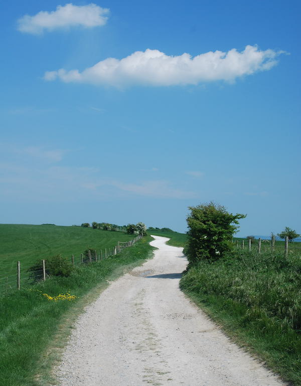
Terrain-wise, the land you’ll walk over consists largely of smooth hills that undulate gently and attractively; whenever I used to wipe the peach-perfect backside of my two-year-old boy, the smooth curves of his posterior always evoked memories of those South Down hills. And unlike its hairier twin, the North Downs, which is covered in woodland and scrub for much of its length, the South Downs have been largely denuded and are now covered in short, sheep-nibbled grass; a surface that, in my mind’s eye, is as cropped and regular as snooker baize. And whilst the lack of tree cover means that if the weather turns against you there’ll be nowhere to shelter, it does also mean that you get a 360-degree panorama for much of the trail. It is, as one of my friends is wont to say, quite a ‘viewtastic’ trek.
Many of the main attractions of the South Downs Way are not natural, however.
Is the South Downs Way for you?

The oldest bookshop in the UK?
Alfriston, Amberley, West Dean, Rodmell, Litlington – goodness, there are some lovely little places along the way.
The walk over the Seven Sisters is glorious but very hard work and should ensure you finish your trek knackered and sweaty – which is how everyone should finish every trail.
For much of the trail you’re high above the A27, which is often visible, and sometimes audible – but seldom intrusive.
Public transport between the Downs and the capital is very good and it’s possible, with some careful planning and a judicious selection of where to stop each time, to complete the trail over the course of several weekends.
Like other upland paths, the South Downs Way is a great place for dogs and their owners. The livestock that does live up there tends to be separated from the path by fences, there are few roads to cross and lots of open countryside for your dog to run around in. You have to be vigilant, as always, but this is a trail your dog will love. Just watch out for the cyclists!
There’s something magical about watching a kestrel hover, motionless, on the wind, especially if you’re stationed above the kestrel as it hunts; and the South Downs is one the best place for this.
Plans have been mooted to flood the Haven which may be beneficial environmentally but it will rob Sussex of one of its most iconic views, most famously rendered in watercolour by the artist Eric Ravilious in 1946. Thankfully, those plans have yet to leave the drawing board.
Most trails have one stretch which, well, isn’t quite as charming as other bits. But the South Downs Way is really good at sheltering you from the south of England’s seamier stretches. Sure, there are a couple of busy A roads to negotiate, which aren’t pleasant. But when I was discussing with my partner what stage of the trail was the least enjoyable, the best we could come up with was the cafe at the Queen Elizabeth Country Park (a bit charmless) and the walk from there alongside a car park and under the busy A3. That, in total, is about five minutes’ worth, which is not bad for a trail that’s around 100 miles long!

The nicest bit of Eastbourne?
Useful info on the South Downs Way
Transport to and from the path
The South Downs Way is perhaps the easiest National Trail to get to – and depart from. Though its southern location puts it a long way away from many Brits, the transport connections to Winchester and from Eastbourne are excellent, with both served by train and National Express coaches.
Transport along the South Downs Way
Transport along the South Downs Way is similarly impressive, with most towns served by buses and several – Arundel, Pulborough, Plumpton, Lewes – by train too. For the buses you may have to change at Bognor, Chichester, Brighton or Newhaven and get a second bus to your destination, but there will be a bus service of some sort for many places; though again you’ll probably have to leave the trail to get to the nearest bus stop.
Walking the South Downs Way with a dog
Walking the South Downs Way with your dog doesn’t present any particular problems, though there are a lot of sheep about (and, to a lesser extent, cows) so be prepared to keep him or her on the lead for a fair bit of the walk.
The main danger to your hound on the trail is at the trail’s end, where the cliffs are unguarded and there are plenty of rabbits about – a lethal concoction and plenty of dogs have plunged to their death in the excitement of the chase.
Otherwise it’s a pretty straightforward stroll for your pooch – as evidenced by the number of dog walkers you’ll meet on the way.
 So where might I get lost? As a National Trail you’d expect the signage to be pretty good – and the South Downs Way doesn’t disappoint in this regard, with well positioned signposts at all the major junctions. Given that you’ll be walking on the top of a ridge in an easterly (or westerly) direction for much of the time, it’s really quite hard to lose your way.
Where you may get lost is when you drop down off the trail to get to a nearby town. Often there’s a sign at the start to tell you what path to take, but thereafter you’re on your own and just have to assume that if you’re going downhill, eventually you’ll arrive at your destination. Usually your assumption is right, but occasionally you may have to climb a fence or two to make it.
Camping and accommodation along the South Downs Way

East Meon
Camping You can pretty much camp every night along the trail if you wish, though as with all the other accommodation, you’ll probably have to drop to the villages and towns in the valley to find an official campsite. I do know of people who have ‘wild camped’ all the way along the trail but you’ll need to be self-sufficient, because there aren’t many places to buy food along the route. Remember, too, that wild camping is actually illegal, and because the South Downs is now a national park, so they are quite strict at upholding this rule, and even on occasion employ drones and even helicopters with thermal-imaging cameras to check that nobody’s sleeping where they shouldn’t be.
The hostel/bunkhouse/camping barn situation along the Dales Way is fair, though you probably won’t be able to stay in one of these places for every night of the trek. The largest section without a hostel etc is between Truleigh Hill and Rodmell & Southease – a distance of over 20 miles but doable if you put your mind to it.
As for B&Bs and hotels, again you’ll need to drop off the trail to find most of them, though they can be absolutely delightful. It’s one thing to admire the cute little cottages on the trail, but quite another to stay in one; the South Downs Way gives you plenty of opportunities to do so.
Facilities along the South Downs Way

Bakery, Lewes
Food and drink As with the accommodation, so with the food; you may need to drop off the path to eat. Take a packed lunch and other snacks to avoid interrupting your trek and dropping off the path every few hours, otherwise progress will be slow. When you do get some food you’ll usually find it tasty and of good quality. Pub food, in particular, is decent, and the pubs are some of the most interesting and historical buildings along the way.
The local beer is Harvey’s which is brewed right in the heart of Lewes.
Shops, banks and ATMs Just keep an eye on your finances as cashpoints aren’t available everywhere along the trail. Shops, banks, post offices can be found in the valley below the trail.
Trekking companies and baggage carriers There are not a huge number of companies serving the trail. Those that do include Sherpa.
Dangers and annoyances
1) The number one danger on the South Downs Way is probably the heat and dehydration. Chalk is a porous substance so water tends to percolate through the soil, and there aren’t many drinking taps or cafés on the way where you can fill up your water bottles. Add to this the fact that the path is very exposed and, while not exactly tropical, this is the warmest part of the country – and it’s easy for the unwary to quickly develop a thirst. Especially as the only way to slake that thirst is to walk downhill for half an hour to the nearest town. So just make sure you bring a couple of litres with you on the trail each morning – and know where you’ll be able to fill up your bottles later in the day.

Tackling the Seven Sisters towards Eastbourne, the last and toughest challenge on the South Downs Way
2) Beachy Head, towards the end of the walk, is notorious as a suicide spot. Indeed, there’s a chaplaincy team that’s been established to try to persuade people from throwing themselves to their doom. I say this merely to illustrate the fact that the cliffs of the Seven Sisters are very high and there’s no fence or protection between you and the edge. So stay well away from the precipice – it’s not big and it’s certainly not clever to stray too close.
Tips and hints
1) If you can, come out of season. That way you avoid the worst of the crowds, and the weather is more likely to be clement here than elsewhere in the country. Spring (April-May) and autumn (September-October) are lovely times to trek.
2) Arundel, Lewes, Winchester – the three towns I talk a lot about above – are all worth a day if you can build it into your schedule.
3) As I always recommend for every trail, do your planning. That doesn’t mean that you should book all your accommodation etc six months before you even start your trail – that would be too regimented and restrictive and part of the joy of taking on a trail is the freedom. But at least know roughly where you going to stay, eat, get water etc etc; you’ll save a lot of legwork and heartache if you do.
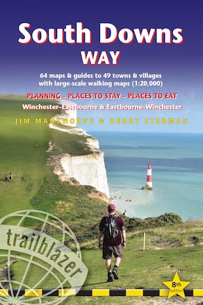
The South Downs Way: Further info
The South Downs Way Guide!
‘Another great guide from Trailblazer. I really feel I know exactly what to expect if I ever walk the trail. In fact I almost seem to have already done it – the guide paints a wonderful picture of this beautiful part of England. Well done JM.’ Walking Britain
‘Use the sketch maps in Jim Manthorpe’s excellent Trailblazer guide’ The Sunday Times
‘Excellent‘ Adventure Travel Magazine
‘Recommended‘ Country Walking Magazine
‘This great little guide is a must‘ Body & Soul Magazine
The South Downs Way is a 100-mile National Trail footpath which follows the line of chalk hills stretching from Winchester to Eastbourne in southern England. Walking the length of the Downs is the best way to experience this beautiful landscape with its mixture of rolling hills, steep hanging woodland and windswept fields. You’ll also pass through picture-postcard villages with welcoming pubs, thatched cottages and country gardens.

* 82 Maps: 60 large-scale walking maps – 1:20,000 (3-1/8 inches to 1 mile) – the largest-scale maps available, 11 town plans, 10 stage maps with trail profiles showing hills and descents, and 2 overview maps.
* Detailed accommodation with reviews: B&Bs, campsites, pubs, hotels, bunkhouses.
* Where to eat with reviews: cafés, teashops, pubs, takeaways and restaurants.
* Comprehensive public transport information with frequency of services for all access points on the Path.
* Downloadable GPS waypoints.
* Itineraries for all walkers, whether hiking the entire route or sampling highlights on day walks, weekends or short breaks.
* Unique mapping features – walking times, directions, tricky junctions, places to stay, places to eat, points of interest written onto the maps.
* Flora and fauna – four page full colour flower guide, plus an illustrated section on local wildlife
* Green hiking – understanding the local environment and minimizing our impact on it.
Buy the book:
To buy the book from Amazon, please click the link below: