
THE CLEVELAND WAY
A horseshoe-shaped path around the perimeter of England’s wildest National Park
Cleveland Way: The Basics
WHERE: The Cleveland Way is a walk that takes place largely within the confines of the glorious North York Moors National Park.
HOW LONG IS IT? 107.5 miles (173km)
HOW LONG DOES IT TAKE TO WALK THE CLEVELAND WAY? 6-8 days
IS IT A NATIONAL TRAIL? Yes
WHERE DOES THE PATH BEGIN? The pretty market town of Helmsley, in the southern half of the national park.
AND WHERE DOES IT END? The coastal resort of Filey, south of Scarborough.
HOW HARD IS THE CLEVELAND WAY? Fairly tough in places. While the trek only just scrapes above 100 miles, the trail is no stranger to some steep climbs and knee-shattering descents.

Introduction

Whitby Abbey
It might seem slightly strange to discover that this was one of the first long-distance paths to be designated a ‘National Trail’, having been bestowed that honour way back in 1969. Only the massive Pennine Way that strides confidently through the very centre of the Britain is older, having been designated a National Trail four years previously.
How curious, you may think, that those good people at the National Trail office should follow up the mighty Pennine Way with what is, by comparison, a rather diminutive, horseshoe-shaped path huddled around one small corner of England. At 107.4 miles (172.9km), its length is less than half of that of the Pennine Way (268 miles/431km). What’s more, the Cleveland Way is confined solely to one country, England, and indeed one county, Yorkshire, whereas the Pennine Way crosses Derbyshire, Lancashire, Yorkshire, Cumbria, County Durham and Northumbria before breaching the border into Scotland. The Cleveland Way also climbs to only 454m (1489ft) above sea level at its highest point at Urra Moor, as opposed to 893m at Cross Fell on the Pennine Way; and focuses on only one National Park, the North Yorkshire Moors, where the Pennine Way visits four. And even today, the Cleveland Way is visited by only ten thousand people per year – as opposed to the Pennine Way’s fifteen thousand-plus.
Given all the above, you may find yourself wondering why anybody would choose to walk the Cleveland Way at all. Because if the Pennine Way is a path that proudly strides along the very backbone of England, then the Cleveland Way could be seen, geographically speaking, as nothing more than a stroll around its armpit.
Is the Cleveland Way for you?
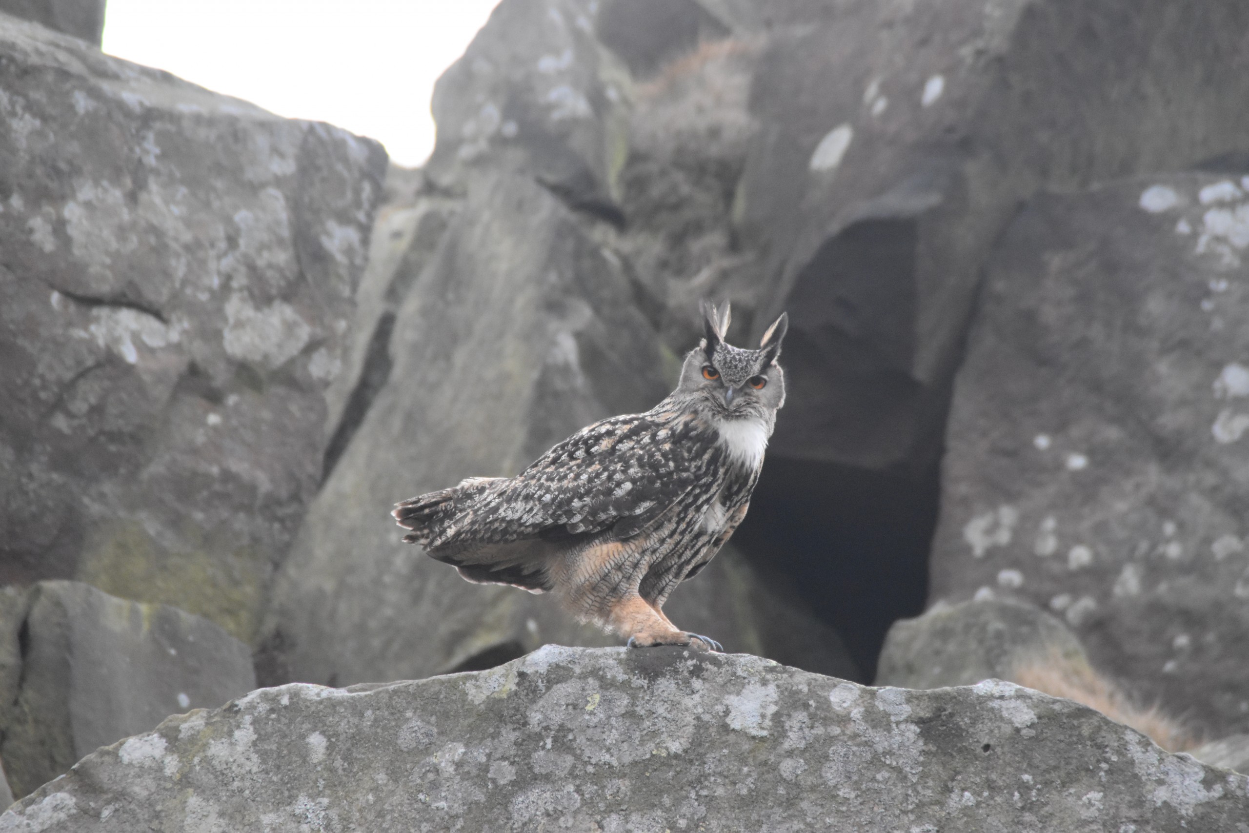
Eurasian eagle owl, nesting at the Wainstones
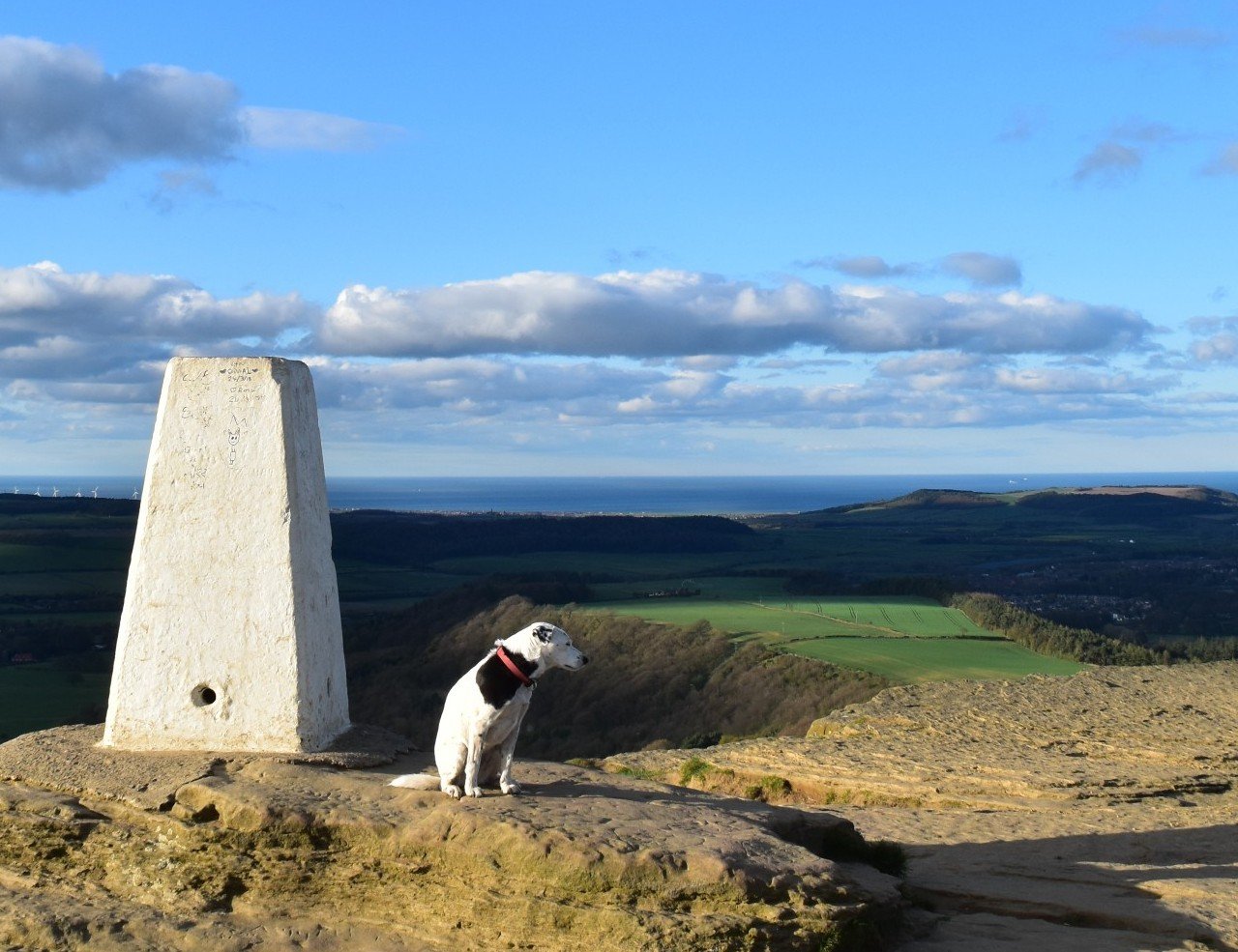
Daisy at the top of the delicious-sounding Roseberry Topping
Useful info on the Cleveland Way
Transport to and from the path

Seen at Scarborough Station
Travelling to the Cleveland Way by public transport, trekkers will probably call in at either York or Hull – even though neither place is anywhere near the trail. Both of these places have train stations, from where you can catch buses heading to Helmsley (from York) or Filey (from Hull).
The guide book does have a comprehensive public transport guide but it always pays to check online in case services have changed/disappeared since publication.
Transport along the Cleveland Way
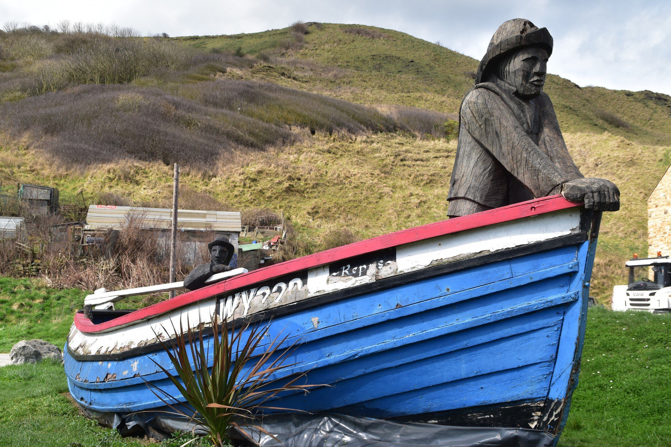
The Repus Sculpture at Skinningrove
The problems with public transport largely lie on the first part of the trail, between Helmsley and Skelton. Helmsley is well connected by bus to Scarborough and Sutton Bank (which the bus visits on its way to York), and there are a couple of bus services connecting Osmotherley with Newton-under-Roseberry. But other than that you’ll have very little chance of catching a bus. And you won’t see a train either.
Transport up and down the coast along the second half of the trail is pretty good, though you’ll be disappointed to find that there isn’t just one bus or rail service connecting all the coastal settlements together.
Walking the Cleveland Way with a dog
There are no particular dangers or worries about taking a dog along the Cleveland Way. Obviously the biggest danger is the cliffs along the second part of the walk. Hopefully your dog will be sensible enough not to leap off them. But I have met some pretty stupid dogs in my time, so let’s just hope your dog isn’t one of them.
On the first part of the walk do keep half-an-eye open for livestock, particularly sheep, that roam amongst the heather. If your dog has shown any interest in them in the past, do the sensible thing and keep it on a short lead.
Similarly, the moors are renowned for several species of ground-nesting birds so do make sure you keep your dog on a lead during spring and early summer.
Finally, do bear in mind that your dog needs to be in very good physical condition to complete the Cleveland Way – it’s as tough for canines as it is for humans, even though, ironically, they may not bitch about it half as much.
 So where might I get lost? As a national trail, the signage along the Cleveland Way is typically first rate. As an additional aid to navigation, for the Way’s entire second-half you’ll be walking along the coastal cliffs, so as long as you keep the sea to your left (assuming you started in Helmsley) you shouldn’t go too far wrong.
There are a couple of specific places I should warn you about, however. The first is the walk through the tree plantations to Slapewath. As sections of these plantations are regularly chopped down, so the path frequently changes or at least becomes obscured.
The second place where trekkers sometimes have problems finding the trail is at Runswick Bay. The sign that points off the beach and back onto the cliffs often disappears so follow the directions in our guide book (or ask a local) to help you stay on track.
I should point out that with both of these, I don’t in any way envisage that you’ll be lost for hours – merely that, after some pretty strenuous walking, it’s slightly annoying when you can’t find the correct trail, and even more upsetting if the trail you do take is the wrong one
Camping and accommodation along the Cleveland Way

Scarborough Grand Hotel
Camping You can pretty much camp every night on the Cleveland Way if you so desire. Sometimes you may have to walk a little way off the trail but seldom will you have to hike too far to find a spot to pitch your tent.
The situation is similarly positive for hostels and bunkhouses, and if you’re prepared to walk the occasional long day you can pretty much stay in a hostel/bunkhouse or camping barn for all but one night on the trail.
As for hotels and B&Bs, there are plenty of these and if this is your preferred style of accommodation you’ll be spoilt for choice all along the trail. Just remember to book in advance if you’re walking in the high summer or school holidays and/or if you have a canine companion with you.
Facilities along the Cleveland Way
Food and drink You need to plan where you’re going to eat carefully, at least on the first part of the trail. There are eateries at Helmsley (plenty), one at Sutton Bank’s visitor centre, High Paradise Farm, then at Osmotherley, Carlton Bank, Kildale, Slapewath, Skelton Green and Skelton; that may sound like an adequate supply, and it is if you plan your walk carefully and time your arrival so these places are serving food when you visit. But it’s not really that much considering they’re your only options for the first half of the trail until you hit the coast. After that, things get much easier as you hop from one seaside spot to the next.
Shops, banks and ATMs Those who are cooking for themselves are even less well served, with only Helmsley, Osmotherley, Carlton Bank (sort of) and Skelton having a food store of any description. So some forethought on your part will be necessary here to stave off starvation on the first part of the Way.
In short, make sure you’re fully prepared when you leave Helmsley. There are no cash machines and few other services from there to Skelton, over fifty miles and several days away.
Thereafter you’ll find cash machines dotted frequently at the coastal towns and villages along the path as well as other amenities, including outdoor shops in Whitby and Scarborough – again, the first time you’ll have seen one since Helmsley.
Trekking companies and baggage carriers There are lots of companies offering self-guided tours and baggage carrying services. Check out our list in the guide book or do a search online.
Dangers and annoyances
High cliffs and strong winds are not a great combination but the Cleveland Way has both in spades. Keep yourself and your loved ones (including, of course, your dogs) well away from the edge, or your trek could be memorable for all the wrong reasons.
There are some remote stretches, particularly on the first half of the walk and especially between Clay Bank and the coast. Make sure you read up about your day’s trek before you set off and plan where you are going to get sustenance during the day.
As mentioned above, it is possible to get caught out by the tides at Runswick Bay. Study the tide table well before you set foot on the sand. But most importantly, if the tide’s coming in don’t try to outpace it – that way danger lies.
And on a related matter, always fill your water bottle. Water (other than sea water) is scarce and it’s still easy to get dehydrated.
Finally, wear sunhat and suncream to avoid getting sunburn/sunstroke/heat exhaustion.
Tips and hints
1) Though there’s little to do there and it’s not particularly conveniently situated for most itineraries, if there’s one place you should stop for the night it’s Staithes. Sitting outside the quayside café watching the boats bob gently on the water is the perfect place to waste an afternoon, or even an entire day.
2) With such tremendous views all along the trail, as well as a lack of any decent shelter for much of its length, this is one path that is really best done in good, dry weather with clear skies. I recognise that, for many people, any trek can only be undertaken after several months of planning and fixed dates. But if you do have any flexibility with your plans and you’re able to shift your dates at the last moment, try to undertake the Cleveland Way when the forecast is good. You’ll be glad you did.
3) Planning a picnic or two along the trail is a good idea. In some cases a lack of cafés and other eateries mean that you may not have a choice. In other places, while there may be a café, it may not be the most charming option. So buy your food in advance and plan a cliff-top picnic for at least one of your days on the trail.
4) If you’ve arrived by mobile home or camper van, Helmsley, at the very start of the trail, has a car park by the start of the walk where you can park your vehicle overnight and stay free of charge. I recognise that this will only be of interest to a very small number of walkers – and its worth pointing out that you do still have to pay for parking during the day – but its such an unusual facility that I thought I’d mention it.
5) Aim to avoid Scarborough and Whitby at the weekends. They’re much more pleasant and sedate during the week.
The Cleveland Way: Further info
- Official National Trail guide to the Cleveland Way
- Wikipedia write-up of the Cleveland Way
- That Sunday evening BBC staple, Countryfile, has its own magazine (who knew?) and occasionally write about long-distance walks (who knew that either?). Here’s the Countryfile article on the Cleveland Way.
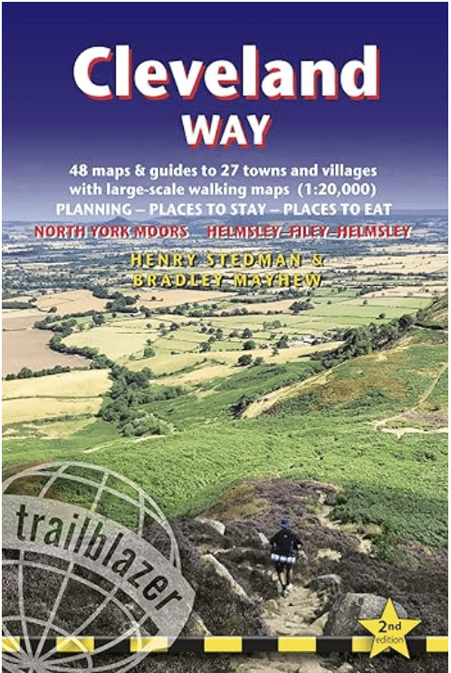
The Cleveland Way Guide!
‘Recommended’ The Daily Telegraph
‘A wealth of information’ Backpack Magazine
‘A heavy inducement to visit one of the less-trodden National Trails.’ Strider
‘Ideal.’ Outdoor Enthusiast
Comprehensive, all-in-one guide to walking the Cleveland Way, Britain’s second-oldest National Trail.

The walking guide includes:
* 48 large-scale walking maps at just under 1:20,000 – showing route times, places to stay, places to eat, points of interest and much more.
* Town plans, colour stage maps and altitude profiles of the entire way
* Places to stay with reviews Pubs, hotels, B&Bs, hostels, bunkhouses, campsites.
* Places to eat with reviews Teashops, cafés, takeaways, pubs, restaurants.
* What to see along the way Historical, cultural and geographical background information.
* Itineraries for all walkers Whether walking the route in its entirety over a week to 10 days or sampling the highlights on day walks and short breaks.
* Comprehensive public transport information For all access points on the path.
* Flora and fauna Four page full colour flower guide, plus an illustrated section on local wildlife.
* Green hiking Understanding the local environment and minimizing our impact on it.
* Downloadable GPS waypoints.
* The information is written onto the maps Walking directions, tricky junctions, places to stay and eat, points of interest and walking times are all written onto the maps themselves in the places to which they apply. The maps are not general-purpose ones but fully-edited maps drawn by walkers for walkers.
Buy the book:
To buy the book from Amazon, please click the link below: