The Dales Way: The Basics
WHERE: Starting just outside the southern boundary of the Yorkshire Dales National Park, within a couple of miles of the start you’re entering the park and will spend the next few days within it, before continuing north-west to finish in the Lake District National Park.
HOW LONG IS THE DALES WAY? 81 miles
HOW LONG DOES IT TAKE TO WALK THE DALES WAY? 6-8 days
IS IT A NATIONAL TRAIL: No
WHERE DOES THE DALES WAY BEGIN? Ilkley, an attractive Yorkshire town on the southern edge of the Dales National Park
AND WHERE DOES IT END? Bowness-on-Windermere, a tourist town in southern Lakeland.
HOW HARD IS THE DALES WAY? Pretty easy. The penultimate day is long, remote and with few places to stop on the way; but otherwise it’s a short walk overall, fairly difficult to lose your way and reasonably straightforward.

Introduction
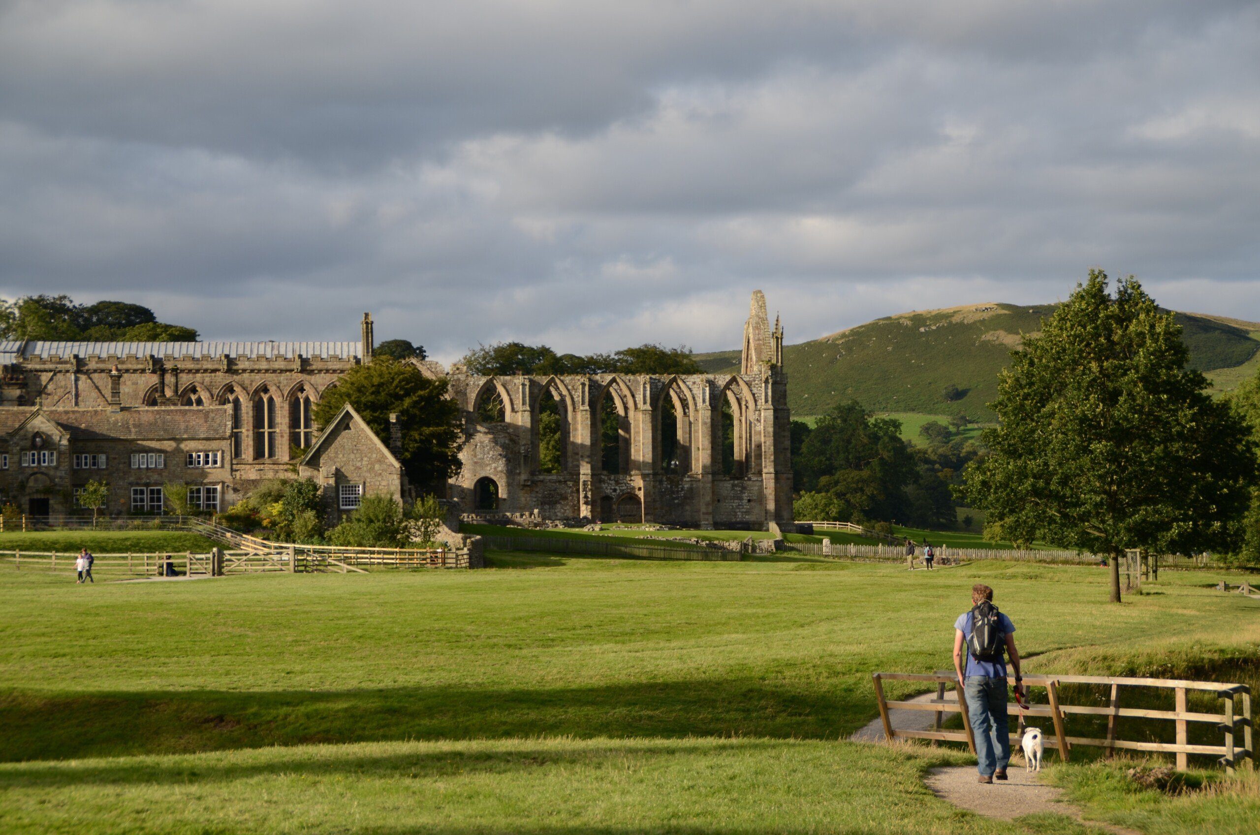
Bolton Abbey, at the end of the first day’s walking
The Dales Way is often described as one of the easiest of the long-distance paths in Britain, and it’s true that most of the first half of the trail is largely level as it follows the meandering River Wharfe. The walk is not entirely without gradients, of course, and there are steep sections, particularly as the path approaches the source of the Wharfe and the watershed, and again on the approach to the Lakes. It’s likely that you’ll also have to complete a couple of long days on the trail, too, as the path passes through countryside where facilities and accommodation are scarce.
Nevertheless, the fact remains that the Dales Way is one of the UK’s shortest and most straightforward long-distance trails. Finding and sticking to the trail is also particularly easy, thanks to the wealth of signposts along the way and the superb maintenance of the trail.
Is the Dales Way for you?

Lune Viaduct, one of several on the trail
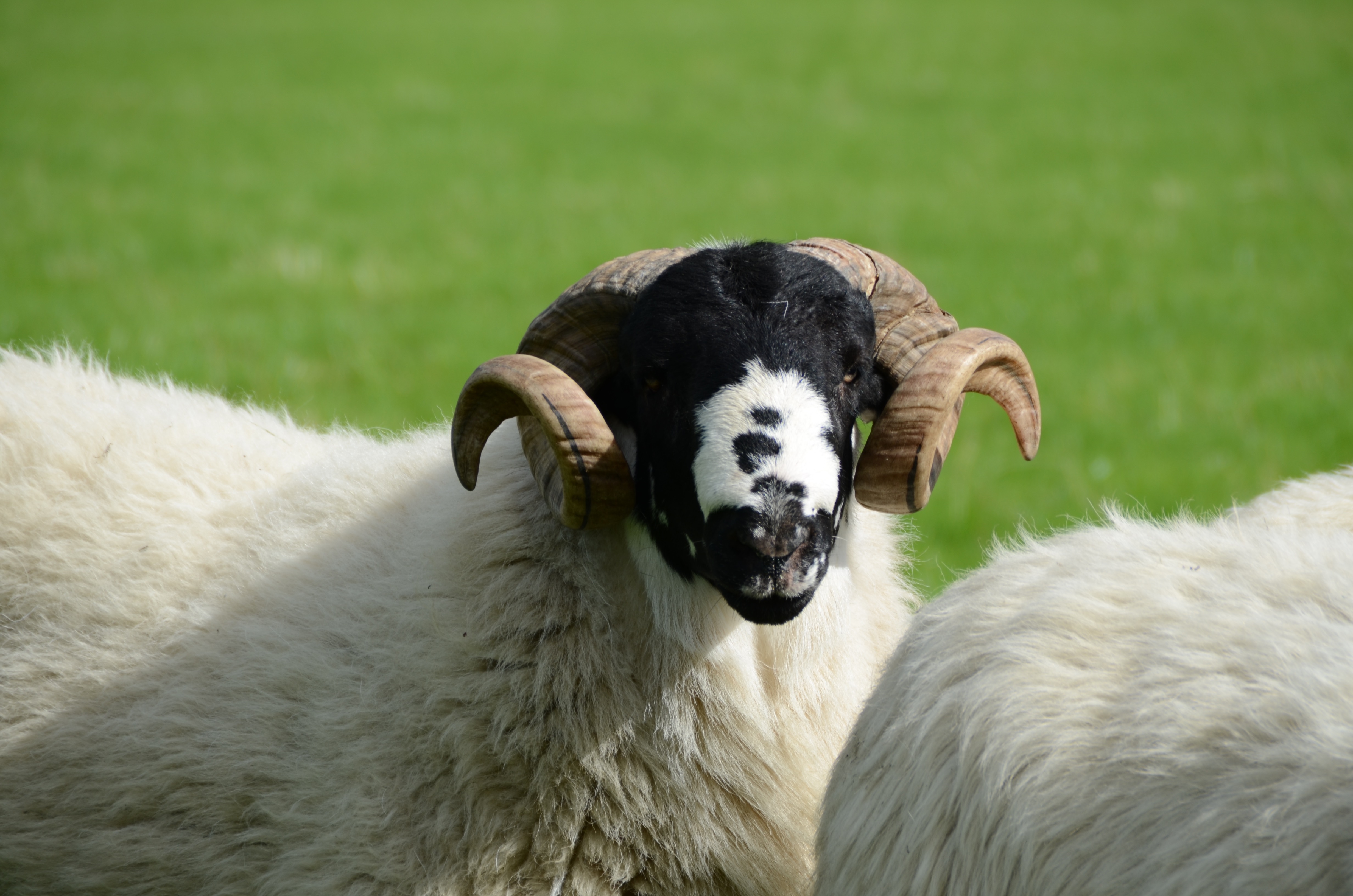
One of the local residents
Useful info for those walking the Dales Way
Transport to and from the path
Getting to Ilkley is relatively straightforward. There’s a train station connecting the town with the major transport hubs of Leeds and Bradford. There are also buses from Leeds.
As for getting back to civilisation at the end of the walk, well one of the (few) advantages of finishing at Bowness-on-Windermere is that it’s fairly easy to get away from, with several buses serving the town. Many of these buses head uphill for ten minutes to the town’s Siamese twin, Windermere, which has a train station that can take you to Oxenholme – which lies on the main London-Glasgow line.
Transport along the Dales Way

Dent Station, the highest main line station in England.
Public transport along the trail is not great. It’s OK for the first part of the trail: bus 74 does a good job of serving this initial section, starting in Ilkley and finishing at Grassington, and calling in at Addingham, Bolton Abbey and Appletreewick. From Grassington the 72A then takes over, going all the way up to Buckden via Kettlewell. But there’s nothing to take you from Buckden over the watershed to Dent, and only the occasional bus from there to Sedbergh. Similarly, there’s no direct connection from here to other points further along the trail, though Burneside, Staveley and Windermere – which are all along the last ten miles of the trail – are all connected by train.
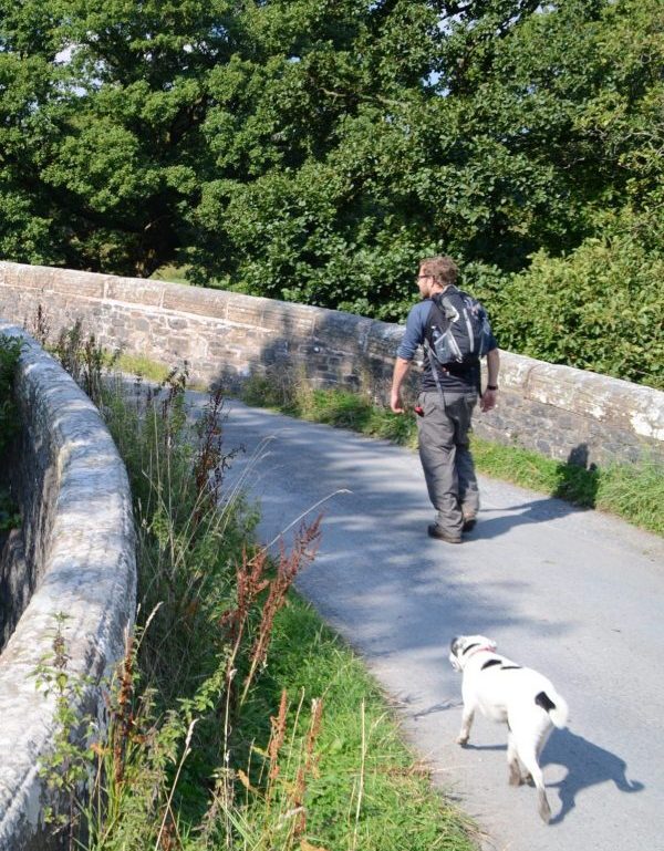
Walking the Dales Way with a dog
The ornate Barden Aqueduct, towards the end of the first stage
As mentioned above, I was surprised at how many establishments refused entry for my dog. For a rural area it was quite surprising. Don’t let this put you off bringing your dog – it’s still easy to complete the trail with them, and you will find enough canine friendly facilities en route to make the walk fairly straightforward – I just didn’t expect it to be as time-consuming as it was to find places that accepted dogs.
Do note that in addition to the frosty reception extended to my bitch by the local residents, there are also lots of cow fields and lots of sheep fields that you’ll be walking through on the trail and the residents of these aren’t too welcoming either. Just take care and follow the usual rules about walking a dog along the trail.
So where might I get lost? It’s not easy to get lost on the Dales Way. Though it’s not a National Trail the signage is very good; and besides, you’ll be walking along a river for most of the first few days. The only place where you may have trouble finding your way is crossing the watershed after Buckden, where the mist rolls in and the signposts are not as plentiful as they could be. But don’t be concerned: as I write in the book, “…there may be occasions where you have to pause, scratch your head and study the maps in this book closely – you may initially even choose the wrong path – but it usually becomes obvious pretty quickly that you’ve made a mistake and need to head back to join the correct trail.”
Camping and accommodation along the Dales Way
 Camping Campers are well served along the trail and it’s possible to camp every night. There are a couple of caveats to this, however. Firstly, Ilkley, Grassington and Sedbergh, three of the biggest places along the trail, do not have campsites within a two-mile radius of them. Secondly, if you’re planning on cooking your own food too, then do note that there are a couple of big sections, between Buckden and Dent, and Sedbergh and Burneside, where there are no stores; so plan your trip carefully so you know when to pick up provisions, and where.
The hostel situation along the Dales Way is pretty hopeless. There’s a YHA at Kettlewell and independent ones at Kendal and at Bowness-on-Windermere at the end of the trail – but that’s it. That makes them useful if you’re camping but just fancy a night under a roof every now and again, but not enough upon which to build an itinerary.
As for B&Bs and hotels, there are plenty of these and some of them are charming. Remember to book your B&B well in advance, however, particularly in summer – it can get very busy. And if you’re travelling with a dog, it’s even more important to book in advance because there aren’t that many that accept dogs.
Facilities along the Dales Way

Burnsall, Wharfedale
Food and drink There’s some great food on the trail (our favourite meal was at the delightful Craven Arms at Appletreewick) but, as usual, the second half of the trail, once you’ve crossed the watershed, can be tricky. After the pub at Buckden there are no eateries on the path until Dent, so for lunch on that day I had to walk a mile and a half from the trail to Ribblehead and eat at the pub there. Similarly, on the 16-mile schlep from Sedbergh to Burneside there is nothing on the way so make sure you carry a packed lunch with you. Even when you get to Burneside the times when the pub there (the Anglers Arms) serves food are quite limited so you may have to catch a train to Kendal to get something to eat. So, as usual, plan ahead. If you’ve got the book you’ll know where the pubs and cafes are but if you can, ring ahead to make sure they’re still open and serving food.
Shops, banks and ATMs You need to keep at least one eye on your finances and supplies when on the trail, for if you run out of either you may have a lengthy walk ahead of you before you reach a place where you can replenish either. As usual, the first part of the walk is more walker friendly, and there are enough settlements on or near the path where you can get money out and buy food etc. But after Buckden it suddenly becomes a very remote trail – beautiful, but remote, with no shops on the way. Similarly, after Sedbergh, though you’ll be walking through farmland rather than the windswept moorland of the previous stages, shops are pretty much non-existent until you reach Burneside, about 16 miles later.
Trekking companies and baggage carriers Most of the big companies – Sherpa, Macs Adventures, Briagantes and many others – offer a luggage-carrying service and the whole self-guided tour package. HF Holidays was the only company that was offering guided tours when I researched the book and I believe that’s still the case today.
Dangers and annoyances
Despite the fact it’s a short trail and for much of it a fairly straightforward one, you do need to take care on the big march over the watershed. It’s remote, it’s exposed and the mist can roll in and obscure the path. Shelter can be hard/impossible to find on this stretch of the trail unless you’re prepared to huddle down behind some drystone wall or a particularly obliging cow. And if you’re walking in winter temperatures can plummet significantly, which could lead to serious problems. It pays to be well prepared with warm clothing and good waterproofs.
Though the first part is much ‘cosier’ and closer to civilisation, it still pays to be careful. You are, after all, walking along a riverbank for much of this section and the river can be dangerous at times. Famously, the Strid – a short stretch of rapids in the heart of the woods – has claimed several lives down the years. Though it doesn’t look much on the surface, there are some dangerous undertows that drag their victims into underground caverns where there’s no air. Here’s a snippet of nineteenth-century poet Samuel Rogers’ composition on one such disaster, titled The Boy of Egremond:
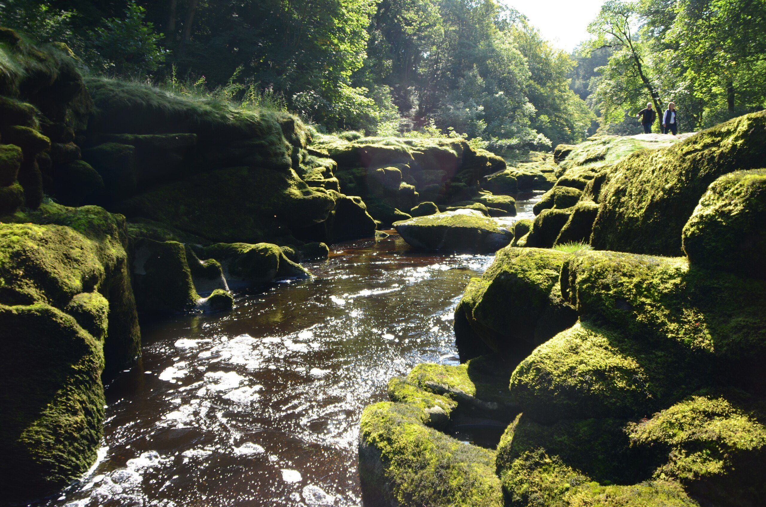
It may look benign – but beware the Strid!
In tartan clad and forest-green,
With hound in leash and hawk in hood,
The Boy of Egremond was seen.
Blithe was his song, a song of yore;
But where the rock is rent in two,
And the river rushes through,
His voice was heard no more!
‘Twas but a step! the gulf he passed;
But that step–it was his last!
As through the mist he winged his way,
(A cloud that hovers night and day),
The hound hung back, and back he drew
The Master and his merlin too.
That narrow place of noise and strife
Received their little all of Life!
Apparently, if you see a ghostly apparition of a white horse near the Strid when you visit, it means you’re going to be its next victim. So best keep away if you do.
Tips and hints
1) You could say that the Dales Way is a trek of two halves. Initially, as you’re walking up Wharfedale, the walking is easy and there are plenty of places on the way where you can stop, rest and restock: Grassington, Burnsall, Kettlewell, Buckden…. It’s almost too easy. After Buckden, however, things suddenly change. You still have over fifty miles to go (around 53 to be precise) – but there are only really two settlements, Dent and Sedburgh, and they sit less than 6 miles from each other (and, for most itineraries, neither occur at the end of a full day’s walking). Even the next most useful settlement on the way, Burneside, has little to offer save a shop and a pub – so most people actually catch the train from there to Kendal where there’s much more choice.
Of course, you can still complete the Dales Way without too many problems; you just have to plan the latter half of your walk carefully, and work out not just where you’re going to sleep each night, but where you’re going to eat along the way before you start out each morning.
2) If you only have time to do some of the Dales Way, stick to the first bit (indeed, any bit up to Sedbergh). Though I love the viaducts that you see after Sedbergh, I think the walking and scenery is much better overall on the first part of the trail and there are many more facilities too.
The Dales Way: Further info
- The first place to go would be the official website of the Dales Way Association
- Wikipedia write-up of the Dales Way
- The Long-Distance Walkers Association have their own page on the Dales Way
The Dales Way Guide!

‘Trailblazer really have got it right with their route maps. They rival Wainwright’s mapping for accuracy and detail and if anything are actually easier on the eye to read.’ Backpack magazine, winter 2016
‘Hikers will be delighted’ Evergreen Magazine
Practical, all-in-one duide to the Dales Way, a relatively easy walk that runs for 81 miles (130km) from Ilkley in the Yorkshire Dales National Park to Bowness-on-Windermere in the Lake District.
* 38 large-scale walking maps at 1:20,000 (8cm or 31/8 inches to 1 mile) and 23 guides to towns and villages.
* Accommodation for all budgets – campsites, hostels, B&Bs, guesthouses, pubs and hotels with reviews.
* Places to eat – cafes, tearooms, pubs, takeaways and restaurants with reviews.
* Detailed public transport information for all access points on the path.
* Itineraries for all walkers – for the entire route or weekend and day walks.
* Downloadable GPS waypoints also available on the Trailblazer website.
* Colour overview and stage maps (one stage per page) with trail profiles (showing ascents and descents).
* Walking with a dog: Henry Stedman, the author, was accompanied along the Dales Way by his dog, Daisy.
Buy the book:
To buy your copy from Amazon, please click the link below: