
South-West Coast Path 3:
Dorset & South Devon
Dorset & South Devon
South-West Coast Path 3, South Devon & Dorset: The Basics
WHERE IS THIS THIRD LEG OF THE SOUTH-WEST COAST PATH? On the southern coast of England, the last leg begins on the Devon/Cornwall border and continues eastwards to Poole Harbour in the county of Dorset.
HOW LONG IS IT? 217.25 miles (350km)
HOW LONG DOES IT TAKE? 15-20 days
IS IT A NATIONAL TRAIL? Not in itself, but forms just over a third of the largest National Trail, the South-West Coast Path.
WHERE DOES IT START? The historic city of Plymouth, just in Devon but close to the Cornish border.
AND WHERE DOES IT END? South Haven Point, Poole Harbour, in Dorset.
HOW HARD IS THIS LAST LEG OF THE SOUTH-WEST COAST PATH? It’s pretty tough, as so much coastal walking is in this country. But if this is the last leg of your trek along the South-West Coast Path then it should hold no terrors and you’ll finish it at a stroll.

Introduction
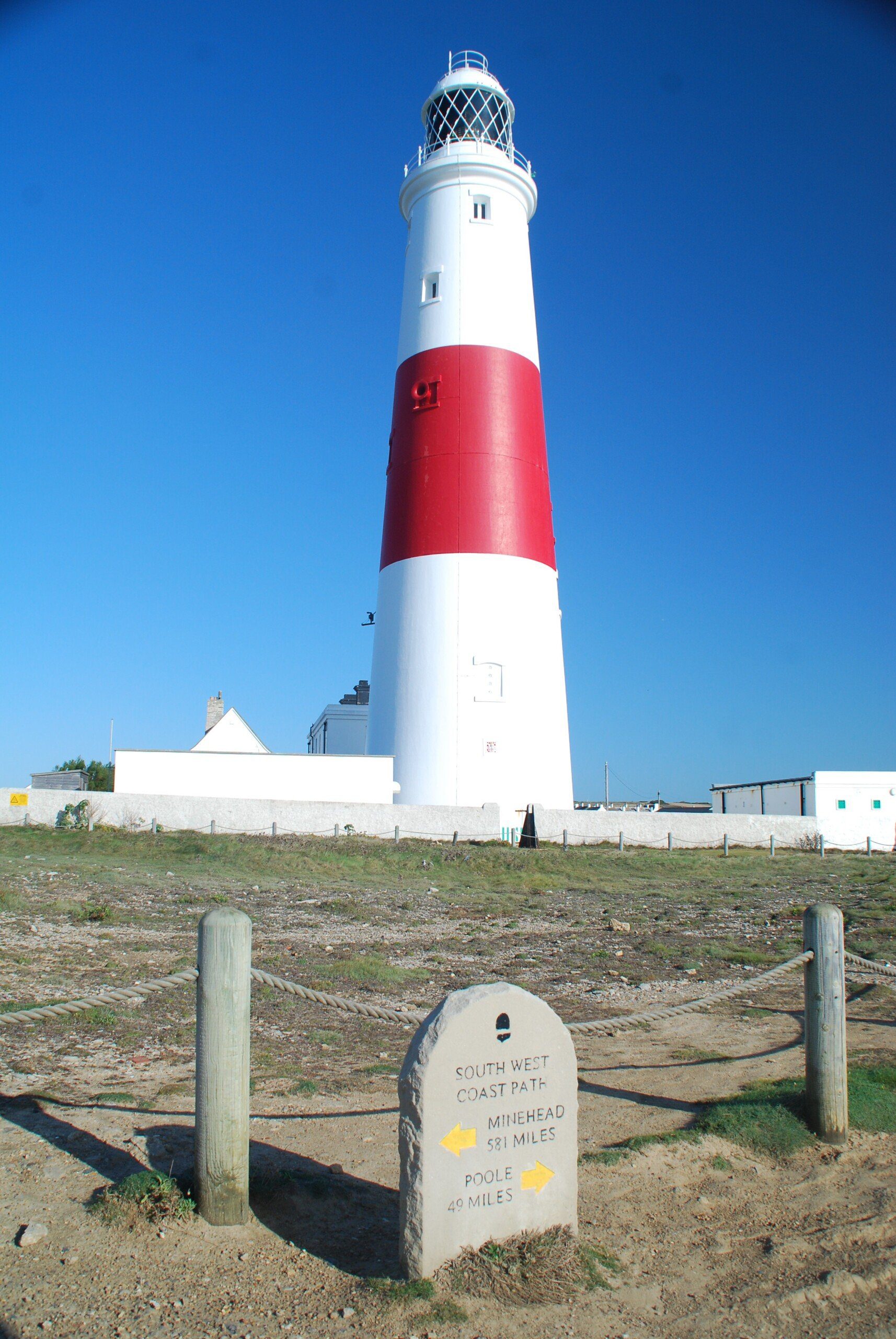
Portland Bill, near Weymouth
And so you come to the final leg of the South-West Coast Path. Two legs and over 400 miles done, you still have over 200 before you can finally say that we’ve completed England’s longest national trail.
But even reaching this point has come at a cost. Because after so long living in the landscape, you’ve started to look like the landscape. The stubble on your chin as coarse and spiky as the grasses of Braunton Burrows; your hair as unkempt and bedraggled as the seaweed on the rocks near Clovelly. Even your complexion has become as wind-blasted and sun-scorched as the sands of Woolacombe Bay. While your buttocks are now as firm and unyielding as the granite outcrops off Land’s End.
Your social skills have suffered. At the start of this trail you greeted every fellow trekker with a cheery ‘Morning’, before pausing, no doubt, to boast of the adventure on which you were embarking .
But they were the smiles before the miles. Now, all other people on the path are viewed as mere impediments, delaying your date with destiny, and if you acknowledge them at all it will be with a quick nod of the head and a gruff, grunted ‘hi’. But it matters not. Given the way you look now, those passers-by are probably just relieved that you didn’t mug them.
Manage to get to the end of this last stage, of course, and our bejewelled and sceptred isle will throw its hands in the air, get on its knees and bow before you. It has thrown its mightiest trail, its most uncompromising landscape and its toughest challenge at you – and you won.
But in order to get to that point, you have to do a bit of walking first…
Is the Dorset & South Devon Coast Path for you?
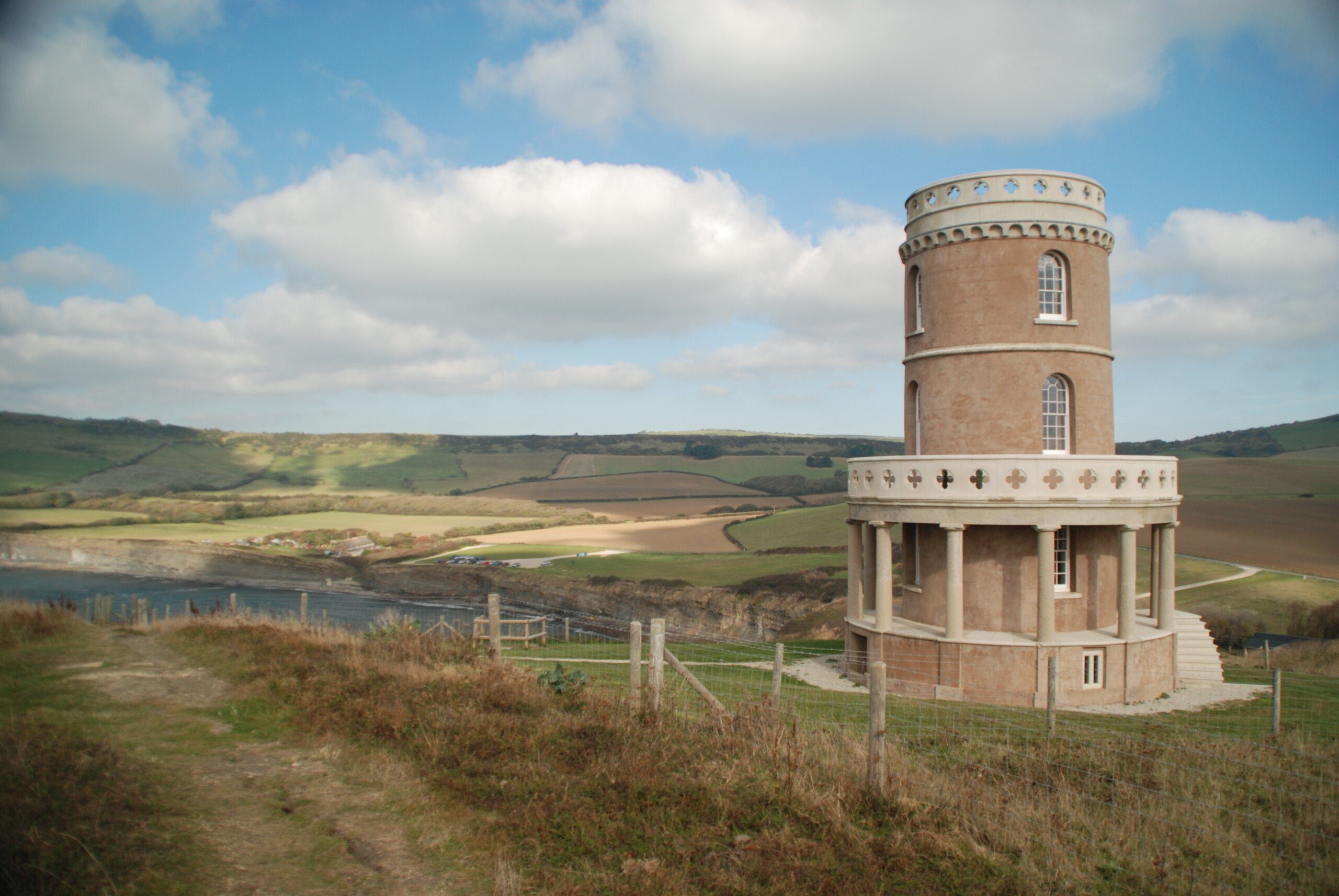
Clavell Tower, near Kimmeridge Bay. You can stay here.

Colour-coordinated resident of Paignton beach huts
Useful info on the Dorset & South Devon Coast Path
Transport to and from the path
This is the easiest leg of the South-West Coast Path to get to and leave. Plymouth is very well connected by train and National Express – as you’d expect a major city to be. At the other end, once you’ve kissed the sculpture at South Have Point that marks the end of the South-West Coast Path, you just need to walk for a couple of minutes to the ferry that takes you across to the posh district of Sandbanks – home to some of the smartest houses in the country – and from there catch a bus into central Poole and the train/coach stations.
Transport along the Dorset & South Devon Coast Path

Seaton Tramway takes you through several nature reserves and is worth the couple of hours it takes
Public transport along this bit of coastline is pretty good, though could be better. For one thing, the transport is rather seasonal; there are buses to most towns and villages in winter, but their frequency is much less than in the summer months. There are also a couple of stretches – between Wembury, Bigbury-on-Sea and Salcombe, and from Lulworth Cove to Swanage – that are poorly served, and travelling to/from these places may well entail a change of bus in places such as Plymouth, Kingsbridge, Yealmpton, Dorchester, Lulworth or Corfe Castle. The guide book does have a comprehensive public transport guide but it always pays to check online, too, in case services have changed/disappeared since publication.
Walking the Dorset & South Devon Coast Path with a dog

It’s not compulsory but Daisy did remove her collar for this section.
Our advice on this part of the South-West Coast Path is pretty much the same as it has been on the other sections.
Before you do anything else, make sure your dog is fit enough for this expedition – it’s very tough going. Secondly, bring a bowl and plenty of water for your pooch (and plenty for you too); it can get very hot on those cliffs and dehydration can be a real issue. Thirdly, there are plenty of places where your dog could drop to his or her death – if you think your dog is too dim to realise this, keep him or her on a lead through these sections.
There is the usual plethora of cow fields on this trail too.
When walking through the Lulworth Ranges, do keep a close eye on what your dog is up to: the last thing you want is for them return to you, tail wagging enthusiastically, carrying a piece of unexploded ordnance in their mouth.
Two other pieces of advice: firstly, before walking on a beach with your best friend, make sure you find out the rules. All beaches have some sort of rule about whether you can walk with your dog on them or not. Most will ban dogs during the high season (May-September). But, if the South-West Coast Path crosses them, you are allowed to walk your dog on them as long as they are kept on a lead and you make your way across the sand as quickly as possible. Others will have some section set aside where you can walk the dog. And always, always clean up any mess from a beach: you’ll be really unpopular if you don’t.
Secondly, don’t forget your tick remover: Daisy collected a few hangers-on on her jaunt along the SWCP and, though she never contracted any nasty diseases from them, Lyme disease is prevalent in that part of the world.
 So where might I get lost? I think that you’re most likely to lose the trail if you’re forced away from the main path in order to walk round, for example, a river mouth or because the ranges are closed. While the authorities do a good job with signposts on the main path, if you’re forced to take one of these diversions you’ll find the signage significantly less frequent and less helpful. If you have a copy of the book or a decent map you should be OK; otherwise you’ll just have to ask anyone you happen to meet on the way if they know the correct path.
Camping and accommodation along the Dorset & South Devon Coast Path
Camping With lots of campsites scattered along the trail you won’t have much problem finding somewhere to pitch your tent. You do, however, have to plan to make sure there will be a campsite near the path and within a day’s walk from where you set off, as there are ‘gaps’ in the path where no campsite can be found. The section from Burton Bradstock (Freshwater) to Osmington is one stretch of almost 40 miles with no campsite along the way, though there is a hostel at Fortuneswell (and one further on at Weymouth) that can ‘fill in’ that gap.
Speaking of hostels, these tend to be situated in the larger places and thus are useful for those who would like to camp, but find there’s no campsite (which is often in these larger towns and cities). Plymouth, Salcombe, Beer, Fortuneswell, Weymouth, Lulworth Cove and Swanage all have either a YHA or an independent hostel.
There are no bunkhouses on this stretch of the SWCP.
As for hotels and B&Bs, there are plenty of these and if this is your preferred style of accommodation you’ll be spoilt for choice all along the trail. Just remember to book in advance if you’re walking in the high summer or school holidays and/or if you have a canine companion with you.
Facilities along the Dorset & South Devon Coast Path

Teignmouth
Food and drink
South Devon is also rightly famous for their delicious crab sandwiches, and smoked eels are a bit of speciality too.
Trekkers, however, are famously unfussy when it comes to counting calories – and why should they be, when they have spent all day burning them off? The cream tea dominates on this leg of the trail as it does in its neighbour, Cornwall – though, of course, in Devon the cream comes first, with jam on top. And just to make 100% sure that no artery leaves unclogged, there’s also Dorset apple cake, which is just perfect with a dollop of the county’s clotted cream.
Shops, banks and ATMs The section from Salcombe to Strete lacks cash machines but otherwise you’ll find them dotted frequently along the path. There are several places on the trail that are large enough to have a shopping centre/High St including Plymouth (of course), Salcombe, Dartmouth, Brixham and Paignton, Torquay, Teignmouth, Exmouth, Sidmouth, Lyme Regis, Weymouth and Swanage. Many of these have some sort of trekking/outdoors store, too, which could prove invaluable if the South-West Coast Path has left your gear in tatters.
Trekking companies and baggage carriers As with the previous stage in Cornwall, the appropriately named Luggage Transfers are the biggest baggage carrying operation on the South-West Coast Path. There are lots of companies offering self-guided tours.
Dangers and annoyances
Keep to the path through the Lulworth Ranges to avoid stepping on anything that may go bang.
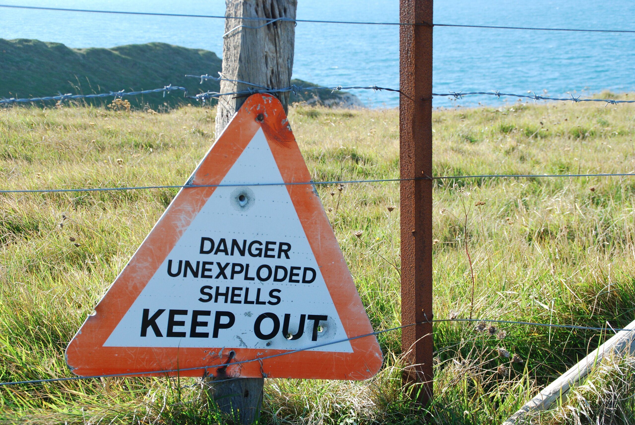
Lulworth Ranges
The most ‘dangerous’ section is actually the Undercliffs. Not because there’s anything particularly dangerous there, you understand; it’s just that, if you do get into any difficulty, there’s no escape route from it, so you’ll either have to march to the end or go back to the beginning.
It’s highly unlikely you’ll be a victim but landslides do happen and, as occurred in 2012 near Burton Bradstock, fatalities can occur. Avoid sitting on the edge or directly beneath a cliff. Just in case.
Always fill your water bottle. This is not the most remote part of the South-West Coast Path and there are plenty of places where you can fill up your water bottles; but there are just as many places where water (other than sea water) is scarce and it’s easy to get dehydrated.
Finally, wear sunhat and suncream to avoid getting sunburn/sunstroke/heat exhaustion.
Tips and hints
2) I’ve already mentioned it several times but do try to plan your trek precisely, and in particular try to time your arrival at the River Ewen for low tide, so you can wade across. Otherwise it’s a helluva diversion to the nearest bridge.
The South-West Coast Path, South Devon & Dorset: Further info
The Dorset & South Devon Coast Path Guide!

‘…three excellent guides to the trail’ The Independent
‘Packed with information and excellent hand-drawn maps, these are essential companions.’ Wanderlust
‘Crammed with practical information on the route and local amenities, wildlife guides and detailed maps.’ Walk magazine.
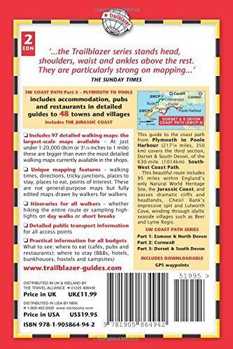
Comprehensive, all-in-one guide to walking the Dorset & South Devon Coast Path, the third and last section of the South West Coast Path National Trail.
The walking guide includes:
* 88 large-scale walking maps at just under 1:20,000 – showing route times, places to stay, places to eat, points of interest and much more.
* 29 town plans, 14 colour stage maps showing hills and descents, and 2 colour overview maps.
* Places to stay with reviews Pubs, hotels, B&Bs, hostels, bunkhouses, campsites.
* Places to eat with reviews Teashops, cafes, takeaways, pubs, restaurants.
* What to see along the way Historical, cultural and geographical background information.
* Itineraries for all walkers Whether walking the route in its entirety over a week to 10 days or sampling the highlights on day walks and short breaks.
* Comprehensive public transport information For all access points on the path.
* Flora and fauna Four-page, full-colour flower guide, plus an illustrated section on local wildlife.
* Green hiking Understanding the local environment and minimizing our impact on it.
* Downloadable GPS waypoints.
* The information is written onto the maps, so walking directions, tricky junctions, places to stay and eat, points of interest and walking times are all written onto the maps themselves in the places to which they apply. The maps are not general-purpose ones but fully-edited maps drawn by walkers for walkers.
Buy the book:
To buy the book from Amazon, please click the link below: