The toughest long-distance trails in England, Scotland and Wales – in order
How did we decide which British trail was the most difficult?
a) how tough the actual walking was; b) how long the path was; and c) how easy it was to follow the path.
If we were to combine the three trails of the South-West Coast Path into one long trail then there’s no contest: at over 600 miles of hard coastal walking, no other trail can compete. But on this website we’ve divided that single national trail into three parts, each corresponding to a separate guidebook, and so we’ve ranked those three sections individually in this table too.
As always, this list is completely subjective, but hopefully provides a rough indication of how difficult each walk is, at least when compared to others – as well as providing something for people to get angry about enough to write in and tell us where we went wrong.
Here’s our list:
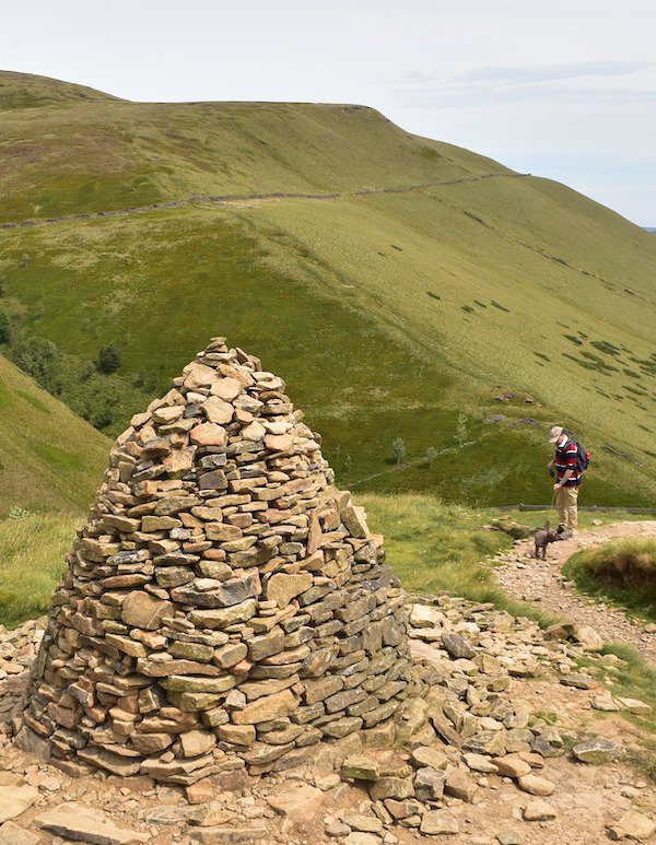
1. Pennine Way It’s probably fair to say that the Pennine Way has actually become quite a bit easier over the past few years. People used to talk about the path as if it was an ordeal rather than a pleasure. But these days there are paving slabs over the boggiest parts, which not only ensures you stay dry but also helps you keep to the correct path too. Nevertheless, the signage on this walk is the worst of any national trail (bring a compass), the gradients are tough, the path is remote (you need to plan ahead to work out where you’re going to buy food), and the whole route is, at 263 miles, the second-longest of the national trails. It is the most wonderful path, but it is tough too, and finishing it still feels like a proper achievement.
2. Coast to Coast This trail ranks highly for several reasons: it’s a long trail, the signage is often absent (especially in those places where you really don’t want it to be), there are lots of very steep climbs and descents, and lots of places where facilities are few. The fact that there are so few signposts is slightly mitigated by the fact that there are often quite a few people on the trail. (We’ve also been very detailed in our guide book, to help you find the correct path, as often the most obvious trail is not the one to take!) Still, completing this trail is a proper challenge – though, admittedly, a very pleasurable one too.
3. Cornwall The middle section of the South-West Coast Path is, at 288 miles, also the longest. As with all coastal walks there’s a lot of stiff walking, with plenty of climbs and descents, many quite steep. It’s also almost 100 miles longer than the Coast to Coast. However, there are plenty of places to stop on the way, and with the sea on one side of you it’s hard to lose your way.
4. Offa’s Dyke This is quite a long walk, remote in places, and the gradients are not to be sniffed at either; however, all of this is mitigated by the fact signposts are plentiful, and there are quite a few places to stop and rest along the way. No matter how difficult, the lasting impression that one takes away from Offa’s Dyke is that it is so pretty, and such fun too; but be prepared to put in some serious effort in order to gain those rewards.
5. South Devon & Dorset Again, we can’t emphasise how exhausting coastal walking can be, and the South Devon and Dorset section of the South-West Coast Path is no exception. What’s more, on this walk you have to time your walking to avoid several rivers that need to be crossed at low tide. Miss the window of opportunity, and you may find you’ve got a 10-12 mile detour to contend with in order to rejoin the route on the opposite bank, which is more often than not just 50 yards away from where you left it. But it’s the schlep around the army ranges near Lulworth Cove and onto Kimmeridge Bay that’s really exacting and exhausting – though it is gorgeous too.
6. Pembrokeshire Coast Path Another coastal walk – and another one that will leave you with calves of steel and a set of buns that could crack a walnut.
7. Exmoor & North Devon Even though this is a relatively short walk, it is tough. Indeed, until the last minute we had this one above Pembrokeshire. But we decided that the fact that Pembrokeshire is 60 miles longer, (which is 3-5 days’ more walking), means it has to go above Exmoor and North Devon in this chart. But be warned: this is a lovely walk, but a hard one too, especially as, in addition to the cliffs, you’re also expected to walk across some great swathes of sand, which is always certain to knacker. To top it all, the last day into Bude is very, very tough (indeed, it was here that I picked up a knee injury that eventually required surgery.)
8. Glyndŵr’s Way Another relatively short walk, and another tough one. The hills can be steep, the terrain is often wet and boggy – very boggy – and the weather is Welsh. There also won’t be anyone to help you if you get into any difficulties – for the simple reason that there’s never anyone around on this route. But what makes this trail particularly difficult is the lack of facilities en route, which means that every day has to be meticulously researched and planned so you know where you’ll be eating during the way, and where you’ll be sleeping at the end of it. Fail to do this and the chances are you’ll be hungry and homeless for at least one night along the way.
9. Cotswold Way There are many people who will be very surprised that we put this walk so high up on this list. A simple mooch around cutesy Cotswold, with excellent signage the whole way to stop you getting lost? Well, those who’ve attempted this trail will know that there are a lot of undulations on this path. Dare we say it, but the lack of incentive to climb them (do we really want another view of Cheltenham?) makes it all the more tricky too.
10. Cleveland Way The Cleveland Way is a lovely path and, being a National trail, pretty well signposted too. But the bottom line is you spend the first half of the trail on the moors, which are bleak and lonely, and the second half on the coastal cliffs, which are rugged and bumpy. There are plenty of places to stop for food and sleep on that second half of the walk – but not many on the first half, when you have to plan carefully. Having lots to see and enjoy on the way makes it slightly more bearable, of course, which is why we’ve ranked this below the Cotswold Way – though there’ll be plenty of other people who’ll disagree.
11. Hadrian’s Wall Path Though it’s very short, the Hadrian’s Wall Path is quite challenging. In particular, the middle section is hard-going, with often blustery weather and an undulating terrain. The lengthy sections at either end, through Newcastle and Carlisle, may be flat but they, too, have their own challenges.
12. West Highland Way Many people who’ve never attempted this trail before assume that it must be fairly difficult: the presence of the word ‘highland’ in its name, and its location amongst some of the highest peaks in Britain, would give you the impression that this is a rugged trail for rugged people. Actually, it’s really rather simple – and surprisingly flat – for much of its length, although it does have a few steep climbs and the signage not as comprehensive as on English trails.
13. Norfolk Coast Path & Peddars Way In contrast to the above, most people assume this trail must be easy because it’s in famously flat Norfolk. And, to be honest, despite a fair bit of beach walking and some less than perfect signage, it is.
14. North Downs Way This path, and the two that follow it in this table, are similar in character. Each are actually ancient tracks that run along high ground, that have been used by Britons since prehistoric times. In terms of difficulty, too, they bear several similarities: the actual walking is quite straightforward once you climb onto the ridge, and the signposting on each is hard to fault as well. Indeed, the main difficulty with each is when it comes to finding facilities such as places to eat or accommodation – a quest that sometimes requires you leave the trail, which will necessitate a 20-30 minute march downhill, and an equivalent walk uphill too to regain the path. We put the North Downs Way higher than those others in this chart largely because it is longer, but also because it’s the least popular, and thus has fewer facilities.
15. The South Downs Way This comes next because it does have a difficult last/first day as you traverse the Seven Sisters to/from Eastbourne.
16. The Ridgeway This is the last of the three ‘ridge’ trails; it’s short, it’s easy to follow and, as it tends to stick to a track rather than crossing fields, it doesn’t even have many stiles to tackle.
17. The London Outer Orbital Path There are shops and other facilities everywhere, the terrain is pretty untaxing, and the transport connections are so good that you can leave the trail pretty much wherever you want. In may ways, the LOOP is a real contender to finish bottom of this list. But there are a few features of the LOOP that drag it up the table. Firstly, and most importantly, it can be really difficult finding your way – the signage is terrible. (We hear that the London Ramblers have taken over the management of the trail, so we’re hoping things will improve.) Secondly, it’s not the most enthralling of walks, and this slight feeling of ‘tedium’ can make it difficult to be enthusiastic about the trail. Thirdly, it is quite long, at just over 150 miles. And lastly, there’s a lot of pavement walking, which can be hard on the knees of elderly walkers. So I’ve been told.
18. Thames Path It may seem perverse putting a trail that’s 184 miles long so far down on this list. But those who have walked the Thames will understand. They’ll remember the fact there’s only one gradient of note along the entire length of the Thames Path – and even that is a pretty straightforward one. With the river as your constant companion, it’s difficult to get lost too. Indeed, the only problems you may have in finding the path is when you’re heading through London; the constant development that takes place in the capital, particularly by the river, means that the path is often diverted and the path to follow is not always clear. Even so, getting lost in London is not the same as losing the path on a bleak and lonely moor, and the consequences are not usually as severe or dangerous either. Finally, there are plenty of places to stop for food and a bed along the way. As if to prove our point, we actually pushed our son along the whole of the path in his push-chair – so we feel quite justified in putting the Thames Path near the bottom of the difficulty chart.
19. Yorkshire Wolds Way If you were to base your opinion of the Wolds Way on statistics alone, then you would probably conclude that this is probably the easiest trek of them all. It is, after all, the shortest of the National Trails, at just 76-78 miles. It also lacks any proper, lengthy gradients of note. Indeed, many websites suggest that this is the trail to take if you’ve never done a long-distance hike before. And I would agree with them, if it wasn’t for one important factor: there are so few facilities – by which I mean places to eat and stay – along the way. Public transport along the route is derisory, too. All of which means that, although the walking itself is, probably, the easiest of all the trails on this site, you need to do a lot of planning beforehand to make sure that you won’t go hungry along the trail, and always have somewhere to stay at the end of each day.
20. Dales Way The gorgeous first section of this walk is very, very straightforward as you walk alongside the River Wharfe. The path is flat, the navigation easy, and there are several places on the way where you can stop for food and provisions. True, it does get a little trickier towards the end as you leave the valley and head out of the National Park towards the Lake District. There are several hills and, in all probability, you’ll have to complete at least one long day’s hiking. But overall this is a very short trail, and a pretty easy one.

Descending from Pen-y-Ghent, Yorkshire, on the Pennine Way

It may be breathtakingly beautiful at times, but will you be too exhausted to notice on the Cornwall Coast Path?

Descending off Hatterrall Ridge, at 703m asl the highest point on the Offa’s Dyke Path.

Schlepping up Dinas Head, Pembrokeshire Coast Path.
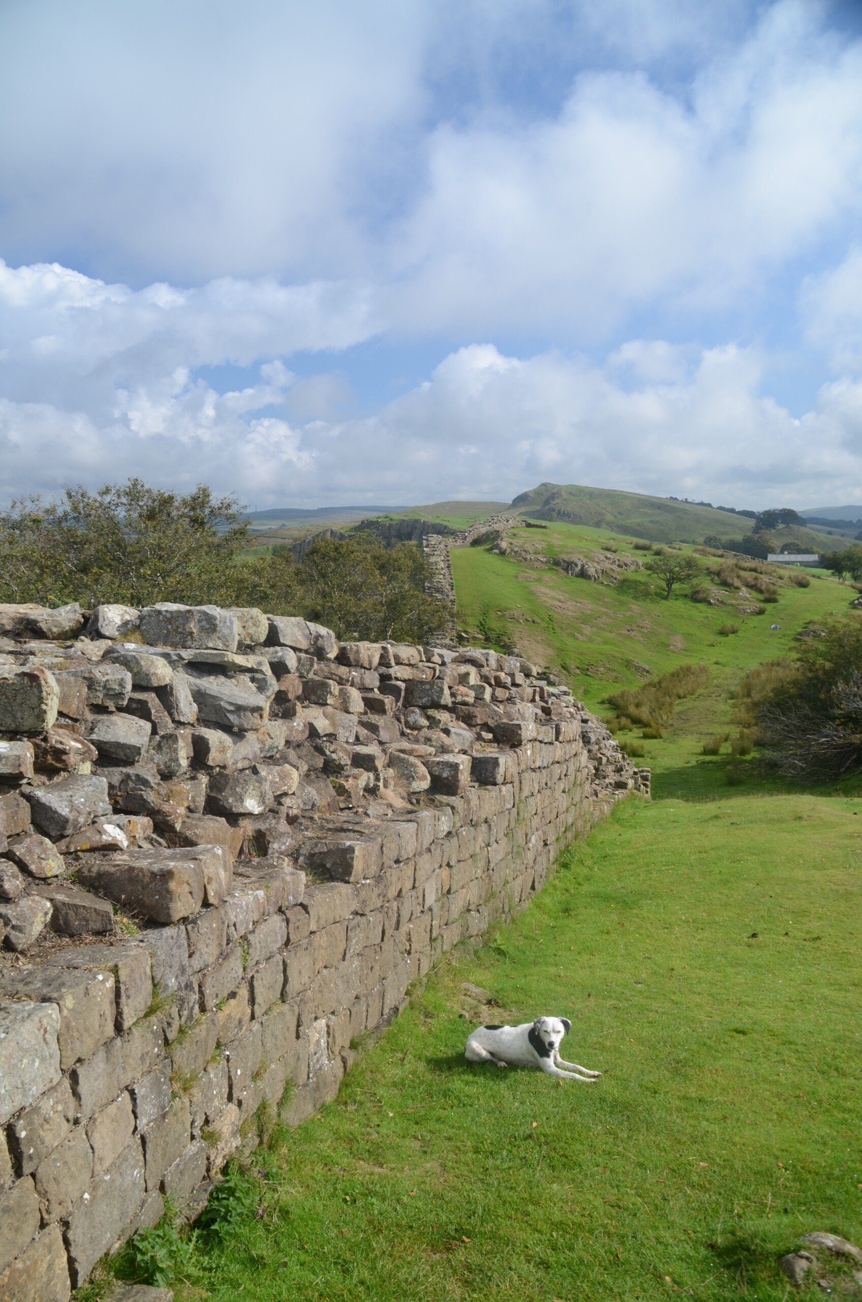
Resting by a decent chunk of Hadrian’s Wall – the middle 2-3 days of this trail are the toughest.
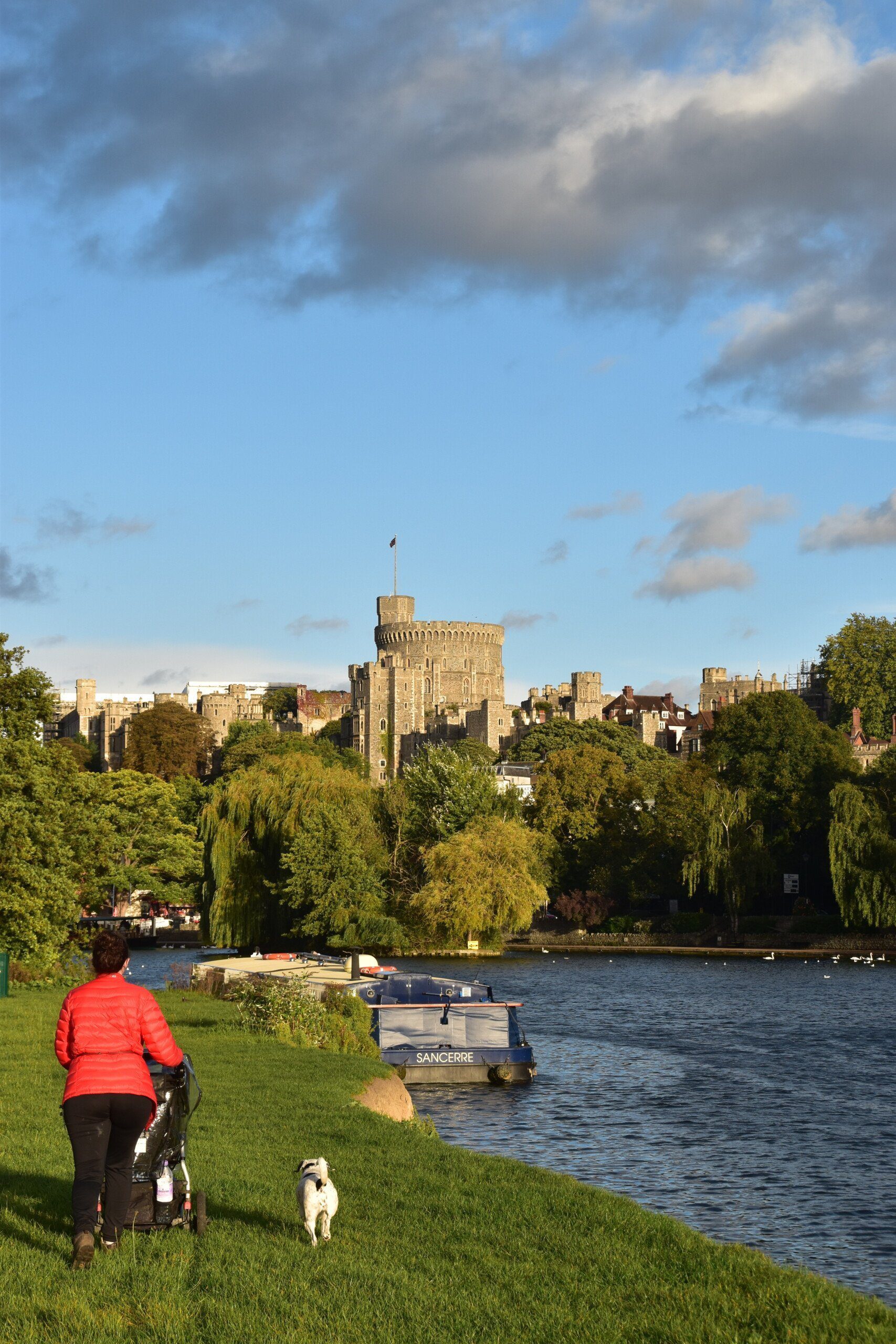
Thames Path – doable, even with a pram.

Dales Way – mostly easy.