The Norfolk Coast Path & Peddars Way: The Basics
WHERE: The Peddars Way marches purposefully north through the heart of Norfolk, finishing at Holme Next the Sea on the county’s northern coastline, where the coastal path then takes you east and south back to the county border with Suffolk.
HOW LONG IS THE NORFOLK COAST PATH & PEDDARS WAY? Peddars Way is only 46 miles/74km, the Coast Path is almost twice as long at 85.5 miles/137km. In total, that’s 131.5 miles or 211km.
WHERE DOES THE NORFOLK COAST PATH & PEDDARS WAY BEGIN? The Peddars Way begins its march through Norfolk on the border with Suffolk, at Knettishall Heath, handing the baton over to the Coast Path at Holme Next the Sea.
AND WHERE DOES IT END? From Hunstanton, near Holme Next the Sea, the Coast Path follows the shoreline all the way east and down to Hopton-on-Sea, a couple of hundred metres from the Suffolk border.
HOW HARD IS IT? Actually fairly easy. The walking itself is straightforward and it’s hard to lose your way. The main difficulty is the lack of services (accommodation, food & transport) actually on the Peddars Way. Overcome that and you’ll find the Norfolk Coast a breeze, with services galore.
HOW LONG DOES IT TAKE TO WALK THE NORFOLK COAST PATH & PEDDARS WAY? 7-12 days
IS IT A NATIONAL TRAIL: Yes

Introduction
If anybody knows anything about the topography of Norfolk, it’s that it’s famously flat. It was, perhaps, for that reason that I didn’t approach this National Trail with my usual enthusiasm. It’s not that I love struggling uphill, feeling my calf muscles pop and my buttocks burn. I know people like that exist, but that’s not me.
But there are two things that hills usually provide you with that I do love; expansive views is one of them, of course; but also peace and quiet. Because if you’ve huffed and puffed your way to top of a steep hill, you can be pretty sure that few other people will have bothered to do the same.
So I wasn’t my usual excitable self as the trek approached. This was the 14th different National Trail that Daisy had tackled, and it was one that, in all honesty, we did because we had finally decide that we needed to complete the set, rather than because I was looking forward to the walk itself. With the OS map free of contours, I just assumed I would be trudging past mile after mile of charmless, fenced-off holiday camps and, in North Norfolk at least, well-heeled residents luxuriating in the million-pound homes, while the rest of us trudge wearily alongside the fence at the bottom of their gardens. I thought it would lack any drama, any sense of the epic, and any adventure.
Which is why, I guess, when I did finally set foot on the trail, that I found the entire hike to be such a wonderful surprise – even if I was right about the holiday camps and million-pound homes.
The National Trail itself is actually two very different walks that just happen to be united by their proximity to each other. Both start close to the border with Suffolk and end within a couple of miles of each other on the North Norfolk shoreline. But in almost every other way, they are very different animals. Those lovely people who look after the National Trails seem to admit as much, by keeping the names of the two paths rather than trying to come up with a new one such as the the Norfolk Circuit or the Norfolk Explorer.
So perhaps I should follow suit and look at each path in turn, starting with the coast…
Is the Norfolk Coast Path & Peddars Way for you?

Windmill at Cley next the Sea

One of many amusement arcades on the seafront at Great Yarmouth
Useful info for those walking the Norfolk Coast Path & Peddars Way
Transport to and from the path
It’s not too difficult getting to Norfolk, despite the lack, famously, of a motorway. For trains, you may well have to head into London before aiming for Yarmouth (for Hopton-on-Sea, a £20-25 taxi ride away), King’s Lynn (for the other end of the Coast Path at Hunstanton and one end of Peddars Way at Holme Next the Sea), or Thetford (a couple of miles from one end of Peddars Way at Knettishall Heath). The coach service National Express also serves each of these places, though if you’re coming from London you’ll have to change at Stansted Airport for either Yarmouth or Thetford, or Norwich for King’s Lynn.
Of course, getting to Norfolk is only half the battle. Once you’ve alighted the train you still need to catch a bus to get to Hopton (bus 1A from Yarmouth) or Hunstanton (bus 34, 35 & 36 from King’s Lynn), while for Knettishall Heath it’s either a fifteen-mile walk along the Iceni Way or a £20-25 taxi ride.
Transport along the Norfolk Coast Path & Peddars Way
 Once again there is a distinct difference between the two Norfolk paths. The first half of the Coast Path is very well served, with three buses combining to cover pretty much the entire north coastline. The east coast is more problematic, but does still have a range of services.
As for Peddars Way? Well you can pretty much forget about using public transport along this remote trail. Trains are non-existent, and those buses that do serve the villages along the way tend to link them to Kings Lynn rather than to each other. So if you want to get from point A on the trail to Point B, you usually have to use two buses, one going into Kings Lynn and one coming back out again to your destination. And that’s assuming Points A and B are actually served by buses, which they probably aren’t. And even if they are, the buses are usually so infrequent as to make the task of synchronising them together virtually impossible.
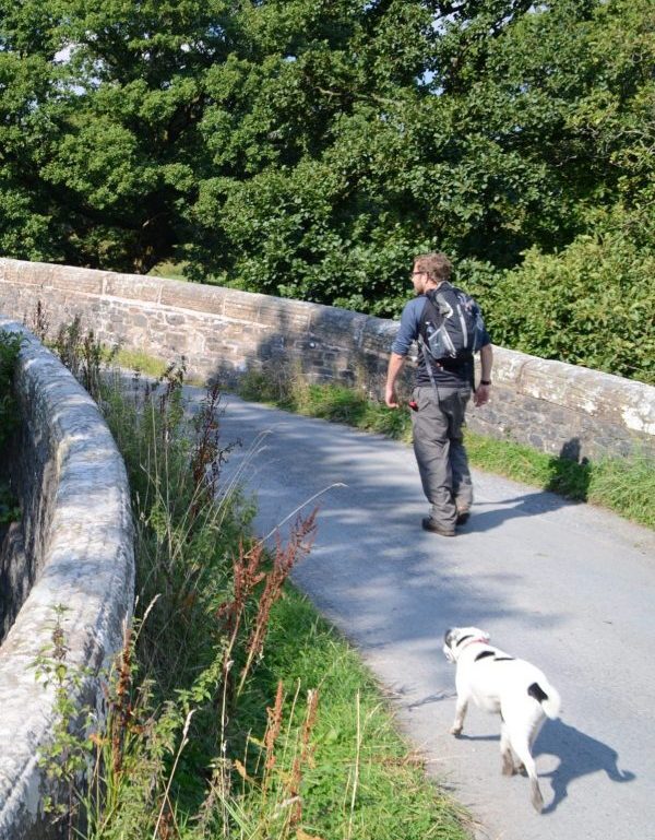
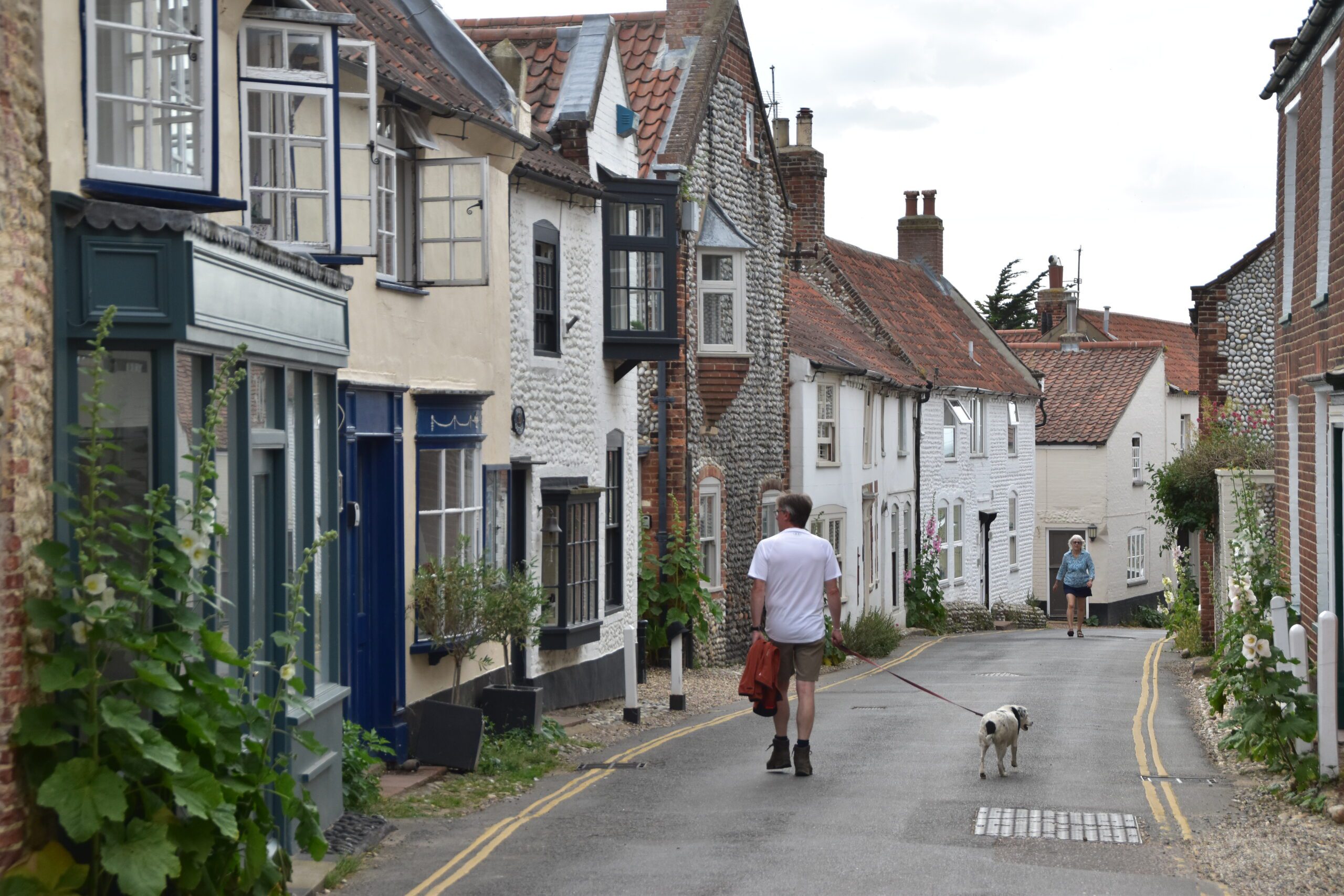
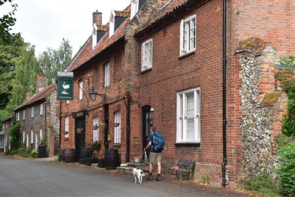
Walking Norfolk with a dog
 I was very pleasantly surprised just how welcoming establishments were to Daisy along the whole trail. Pubs, cafés, restaurants, buses, trains, taxis: all of them were, as a rule, pretty happy to allow her across their threshold. B&Bs and hotels were a bit more problematic, but only slightly.
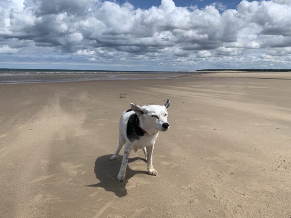
However, it’s fair to say that Daisy did suffer more on this trip than on almost any other – and it was wholly my fault. We happened to walk the Norfolk Coast Path during a heatwave and were caught out by it on three occasions. Thankfully no lasting harm was done, but at Holkham Beach, Salthouse Beach and the Winterton Dunes we had to severely ration our water and give most of it to the dog to ensure she made it through. Water was similarly hard come by on Peddars Way but the heatwave had thankfully dissipated by this time so the sense of panic was not quite so great.
Just take care and follow the usual rules about walking a dog along the trail.
So where might I get lost? The Romans built Peddars Way, and as you can probably imagine they built it to be broad, clearly defined, and, for large stretches, very straight too. The National Trail people do a good job of providing signposts on Peddars Way at places where you might need them, without swamping the path with so many that they blight the path itself.
As for the Coast Path, well, as contradictory as it may seem, it is both difficult to get lost but very easy to lose the path. Signposts are much less frequent here, and it’s difficult to keep to the ‘official’ path the whole time. But of course that doesn’t matter too much; as long as you keep the sea to the same side of you, it doesn’t really matter whether you choose to walk along the beach, through the dunes or even on the cliffs above. You’re still walking the Coast Path, in my opinion, and you shouldn’t feel too bad if you find out, on reaching your destination, that you actually took an ‘unauthorised’ path to get there.
Camping and accommodation along the Norfolk Coast Path & Peddars Way
One of the hardest parts of tackling this National Trail is actually staying on it. There is a thriving accommodation scene in Norfolk, particularly along the coast – it’s just not designed to cater for walkers who probably only want to spend one night at a place, will probably be on a tight-ish budget, might turn up at an odd hour and want to leave early in the morning, and may have a dog in tow too. That’s not how the vast majority of visitors to the county behave – and sensible accommodation owners will, of course, want to cater to the holidaymaking masses rather than the walking minority, no matter how loveable we are. The picture for Peddars Way is no better, with accommodation usually a mile or two from the path and in very scarce supply.
Our advice: be prepared to use a mix of accommodation – camping for some nights, hostel or B&B for others – and do look everywhere for accommodation. Airbnb may be vital in some places too; indeed, in some villages along the north Norfolk coast in particular it feels like every second house is a holiday let and while most won’t want someone for staying just one night, some will and it could be vital for the continuing success of your trek.
Camping Peddars Way is ill-served by campsites. There’s one at Knettishall Heath, at the very start of the trail (and thus, for most people, pointless), and two glamping sites (which are entirely different to campsites, of course, and probably more of interest to hotel-patrons than campers). But there’s nothing else.
The Coast Path is slightly more camper friendly. You can make you way around the entire north coast without needing to darken the doors and towels of a B&B. But the east coast is a different proposition, with only a glamping site at Winterton-on-Sea and a campsite at Waxham, near Sea Palling. Which all seems rather odd, when the trail is lined by holiday parks for much of its length along this stretch (parks that, alas, don’t want campers).
The hostel situation along both paths is pretty hopeless too. On the Coast Path there’s a YHA at Sheringham on the north coast and an independent hostel-cum-campsite on an organic farm at Burnham Deepdale. But with the Red Lion at Castle Acre currently not taking bookings, there are currently no hostels or bunkhouses on the Peddars Way.
Even the B&B/hotel situation is rather dire. Sure there are hundreds of B&Bs and hotels on the Coast Path. But once you take away those that don’t accept one-night stays, or dogs, and that have availability when you want to stay, and are within your budget – well, you’ll probably find yourself with very slim pickings indeed. And Peddars Way is even worse: as we highlight below, there are so few facilities along the actual path that you’ll probably find yourself walking a mile or two off the trail if you need anything, and that includes a bed for the night. And again, even if you are lucky enough to find something it almost definitely won’t be cheap.
Facilities along the Norfolk Coast Path & Peddars Way
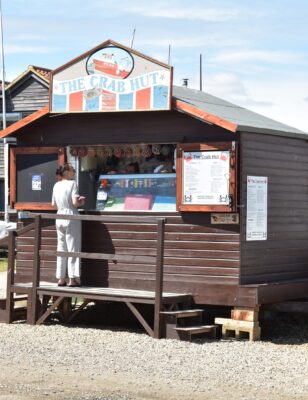
Food and drink One of the undoubted joys of walking in Norfolk is in the eating. The seafood on the coast is fabulous and famous – with Cromer crab a particularly scrumptious local delicacy. But it’s not just the local ingredients but the way they’re prepared that is so great. The North Norfolk coast is one of the most affluent parts of the country and, as a result, the food is a little more fancy. It does make the whole trip more expensive – but can make each meal a culinary adventure too. The Peddars Way is a little more mundane; indeed, often on this part of the National Trail it’s rare that you have a choice of places to eat, and you’ll usually find yourself buying food whether you’re hungry or not, just in case you can’t find any more that day.
Shops, banks and ATMs The north Norfolk coast has plenty of shops, banks and ATMs; the east coast less so, but with careful planning you shouldn’t go short of anything. Peddars Way is a different kettle of fish, however, and outside of Little Cressingham, Castle Acre and Ringstead there are no shops on the trail, though you can find other alternatives if you’re prepared to take a detour or two. The shop at Castle Acre is the only source of readies as well, as they offer a cashback service to customers.
Trekking companies and baggage carriers Hikehelp are the only specialist baggage carrier we know of for this trail. A few big companies, including Contours and Mickledore – offer a luggage-carrying service and the whole self-guided tour package.
Dangers and annoyances
For seemingly such a straightforward trail, the Norfolk Coast Path and Peddars Way are potentially more hazardous than most routes. For one thing, the marshes and mudflats that you walk through on the north coast are particularly treacherous – don’t stray from the path (which usually follows the top of a sea defence) or you could be sucked in, never to return. There’s a reason why you occasionally see one set of footprints heading into the marshes – but none coming out again. Don’t go wandering off, even if you do see something of interest, and if you see a sheep or cow in distress, try to find the farmer rather than attempt to rescue it yourself.
There are also the cliffs, particularly on the eastern coast, that are crumbling into the sea. Walking either on top of them or at their base is, of course, foolhardy.
Tides can also come in very fast around here – make sure you know what the tide is doing and have an escape plan if you get stuck.
The sea can be so inviting on a hot day but again, swimming off the Norfolk coast is not an entirely risk-free activity. There are dangerous undertows and riptides along many of the shores, so make sure you find out from locals where it’s safe to swim. If you can find a beach with a lifeguard, so much the better.
Finally, there are surprisingly long stretches, particularly on Peddars Way but also on the long empty coastal stretches, where it’s impossible to get supplies. Usually this just means you’ll feel a bit hungry. But if it’s a hot day or you’re ill-prepared, you may not have brought enough water for the hike, which can far more problematic and life-threatening. Bring plenty of water.
Tips and hints
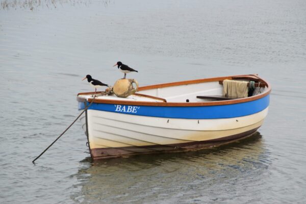
1) Bring binoculars. They’re invaluable for birdwatching – and you’ll be seeing species of birds that you’ve never seen before, and may not even know existed. But they’re also useful for spotting seals in the sea, and seeing if that round black lump bobbing in the water is just a buoy, or something more interesting.
2) Don’t ever set off each day without water, and make sure you replenish it whenever you get the chance. This trail is characterised by stretches where water – other than unpotable sea and marsh water – is unavailable. Add in the lack of shade for much of the coastline and it’s a recipe for disaster. I know this seems like a cosy, twee little trail compared to the mighty Pennine Way or Coast to Coast. But does have its dangers, and dehydration is definitely one of them.
3) We’ve already spoken about the lack of facilities on the Peddars Way, so do pack a few energy bars and other snacks in your rucksack – you’ll be so glad you did.
4) Trying to take a good photo of the marshes? They’re extraordinary places, but capturing this essence of ‘atmospheric emptiness’ is tricky. Indeed, most people just end up with lots of photos of, well, blank spaces. While it might sound counter-intuitive, in order to highlight the lonely tranquillity of the salt marshes, put something in the foreground, such as a bird, or a boat, or a fellow hiker. This has the advantage of drawing the eye into the picture, and adds interest to it. More imprtantly, it also helps to emphasise the emptiness that lies all around.
5) At Hopton-on-Sea, before you start or finish your walk, head south along the coast from the start sign for just a couple of hundred metres; do so and you’ll reach the border with Suffolk – just as you do at the other end of the trail.
Peddars Way & the Norfolk Coast Path: Further info
- The first place to go would be the official website of the Peddars Way and the Norfolk Coast Path
- A thorough look at the Coast Path can be found on this eponymous page
- Wikipedia have a page on the Norfolk Coast Path and the Peddars Way
- The local tourist office also have their own site dedicated to the Norfolk Coast Path
- Explore Norfolk have their own site on the Peddars Way
The Peddars Way & Norfolk Coast Path Guide!
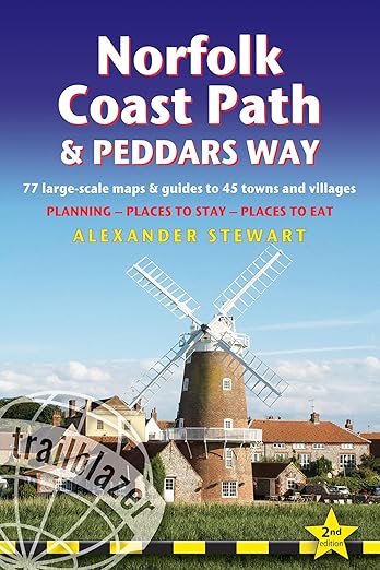
‘Trailblazer really have got it right with their route maps. They rival Wainwright’s mapping for accuracy and detail and if anything are actually easier on the eye to read.’ Backpack magazine, winter 2016
‘Hikers will be delighted’ Evergreen Magazine
Practical, all-in-one guide to the Norfolk Coast Path and Peddars Way, a relatively easy but beguiling walk that runs for 85.5 miles (137km) along almost the entire Norfolk Coast, before heading across the county on the ancient Peddars Way all the way to the Suffolk border.
* 77 large-scale walking maps at 1:20,000 (8cm or 31/8 inches to 1 mile) and 45 guides to towns and villages.
* Accommodation for all budgets – campsites, hostels, B&Bs, guesthouses, pubs and hotels with reviews.
* Places to eat – cafes, tearooms, pubs, takeaways and restaurants with reviews.
* Detailed public transport information for all access points on the path.
* Itineraries for all walkers – for the entire route or weekend and day walks.
* Downloadable GPS waypoints also available on the Trailblazer website.
* Colour overview and stage maps (one stage per page) with trail profiles (showing ascents and descents).
* Walking with a dog: Henry Stedman, the author of this website, was accompanied along the Norfolk Coast Path and Peddars Way by his dog, Daisy.
Buy the book:
To buy your copy from Amazon, please click the link below: