The Basics
WHERE IS THE PATH? Glyndŵr’s Way describes a horseshoe shape through a very remote part of Wales, starting and ending at the Welsh border.
HOW LONG IS IT? 134.5 miles
HOW LONG DOES IT TAKE TO WALK?
8-12 days
IS IT A NATIONAL TRAIL: Yes
WHERE DOES IT START? Knighton, a neat and friendly town right on the England-Wales border.
AND WHERE DOES IT END? Welshpool, less than 30 miles north of Knighton.
HOW HARD IS IT? Hard. Not only are there some big ascents and descents, but the terrain on the high ground is often boggy and the going tough. Transport links are few and facilities scarce, so a lot of pre-planning is necessary so you have somewhere to stay – and something to eat – each day. The weather is notoriously unpredictable in this corner of the world too.

Introduction
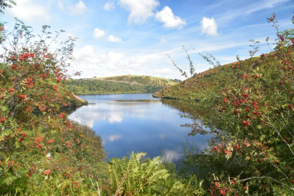
Tranquil Clywedog Reservoir, taken in September when the hawthorn berries are at their most impressive.
This is the only National Trail, and the only trail on this website, that’s named after a person; though if you’re not Welsh, the chances are it won’t be someone you’re familiar with. That person is Owain Glyndŵr, who led a 15-year-long rebellion in the fifteenth century with the aim of overthrowing English rule in Wales.
To be honest, the trail’s link with Glyndŵr is a bit tenuous. The rebellion he led enjoyed considerable success, and in the early 1400s most of Wales came under Glyndŵr’s rule – far bigger than the region visited on this trail. Indeed, other than the parliament in Machynlleth where he was crowned Prince of Wales (and was thus the last Prince of Wales who actually came from Wales), and a couple of monuments erected in his honour along the way, Glyndŵr himself rarely puts in an appearance along the path.
But that’s not really an issue, because very few people, if any, who decide to walk Glyndŵr’s Way do so because of Glyndŵr himself. Instead, in all likelihood, they come because they’ve heard of the trail’s reputation for being one of the most beautiful long-distance paths in Britain.
And it’s true: Glyndŵr’s Way is just lovely. Step after step, the path treats you to birds-eye views of peaceful, verdant valleys, above which loom high, silent hills, their slopes dressed in neat, hedge-lined pasture and meadow, their tops finished with buff, gorse-covered moorland. Walk through this almost forgotten segment of Wales today and you can easily understand why Glyndŵr spent 15 years fighting for it. The region is sandwiched between the two trekking hotspots of the Brecon Beacons, to the south, and Eyri National Park, with Yr Wyddfa (Mount Snowdon), to the north. But give me the beauty and tranquillity of this central part of Wales any day, whose glory can easily match theirs – and unlike them, there aren’t any armies of chattering, gore-tex clad hikers to spoil the scene either.
And that’s one of the other joys of the Glyndŵr’s Way: there’s just nobody around. I think on our own trek we encountered maybe ten other trekkers in total – that’s just over one a day – and only one of those was, like us, tackling the entire trail in one go. Dog-walkers, farmers, other locals – even they were largely absent from this walk. Indeed, even some of the villages we went through felt deserted, and it was often only the sound of a distant lawn-mower or hedge-trimmer that told us the place hadn’t been abandoned altogether.
But while this tranquillity is lovely to experience, it’s also the cause of the biggest problem with the Glyndŵr’s Way…
Is the path for you?
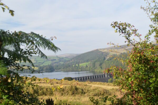
Lake Vrynwy and its awesome dam
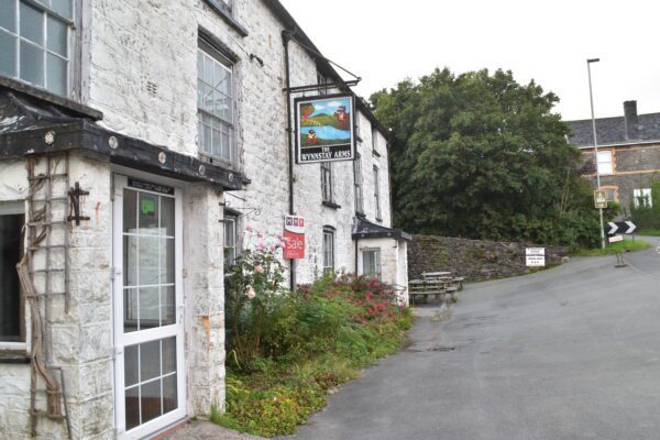
Winnstay Arms at Llanbrynmair. No longer serving food or beer – and is due to close
Useful info for those walking Glyndŵr’s Way
Transport to and from the path
Getting to and from the trail is pretty simple. Knighton and Welshpool are both served by trains from Shrewsbury, which in turn is connected to the rest of the country. Welshpool is also served by the National Express coach service between London and Aberystwyth.
The biggest problem is likely to be faced by those who drove to Knighton and left their car there. Travelling between Welshpool and Knighton is not as straightforward as you would expect of two towns less than thirty miles apart. If there is two or more of you, take a taxi – it costs about £50 and takes about 50 minutes, which is cheaper and faster than taking the three-hour train via Shrewsbury.
Transport along the trail
No other national trail is as poorly served by public transport as Glyndŵrs Way. Apart from Knighton and Welshpool at the start/end of the trail, only Machynlleth has a train station, connecting it with Shrewsbury and Aberystwyth. The bus situation is little better; indeed, the Trailblazer guide lists just a dozen bus services that serve the trail – most other trails have at least three times that.
In short, if you need to leave the trail at any point, you’re probably going to end up sitting in the back of an expensive taxi.
Walking with a dog
Daisy completed this trail in 2024, aged 14, and as far as I can tell she enjoyed it too. I think that actually, far from being a potential obstacle to her taking part in this adventure, her advanced years were a blessing for this trip. In her younger days, Daisy would have had to have been on a lead for much of the trail as we walked through field after field of cows and sheep.
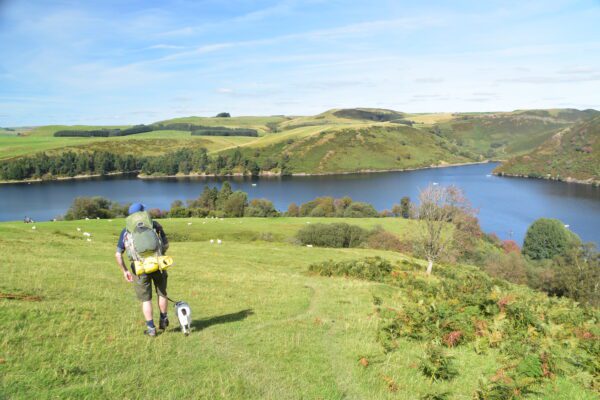
The beautiful Clywedog Reservoir
But these days, as she approaches her dotage, she was completely happy just to trot alongside us, completely unaware, or uninterested, in the local livestock. I can also think of only one place, a cafe-cum-shop, that didn’t let her in; everywhere else welcomed her warmly, despite the mud hanging off her.
Of course, as with all long-distance trails you need to make sure that your dog is up for the challenge. And given the lack of escape routes and terrible lack of both vets and public transport along the way, Glyndŵr’s Way is not the trail to test your pooch’s mettle for the first time. But if you know your dog can handle 135 miles over tough terrain, is good around livestock, and unfailingly returns to your side when called, then by all means bring him or her along. Just remember: when your planning your trip, remember to work out where you are going to get dog food from too – it’s just as difficult to find food for the hound as it is for the human.
So where might I get lost? The National Trail authorities are to be congratulated on putting up as many signposts and finger posts as they have.
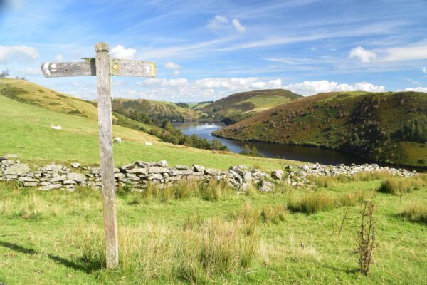
It must be pretty thankless work trudging up and down these hills erecting signposts, particularly as so few hikers come to Glyndŵr’s Way and benefit from them. But this is not easy terrain to find your way around, nor an easy trail to stick to, and several times each day we kept to the trail only because of the fingerposts planted along the way.
Nevertheless, it is still easily possible to lose your way, especially if the mist descend on the hilltops or one of the fingerposts has fallen over. In addition to the guide book, one other vital bit of kit you should take with you to keep you on the correct path is to download a set of GPS waypoints onto your phone.
Camping and accommodation
Wild camping by Lake Glaslyn.
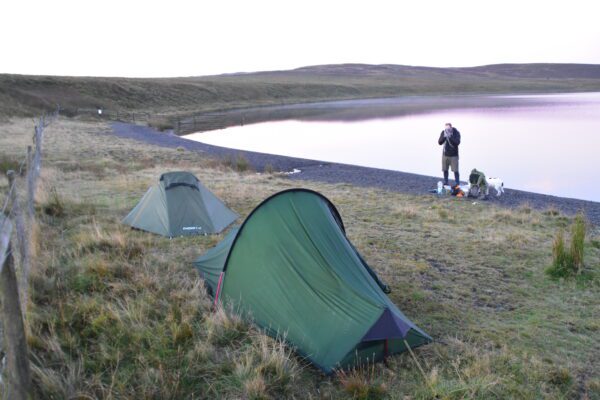
Camping The one area in which Glyndŵr’s Way is fairly well supplied is campsites, and it’s pretty easy to camp every night along the trail. Indeed, it’s one of the few routes where it’s better to camp than stay in B&Bs/hotels, and if it wasn’t for the changeable weather in this part of the world I would recommend it without hesitation. The campsites vary from the back of pubs to ‘proper’ holiday parks, and a couple truly stand out: the campsite at Abbeycwmhir where you sleep amongst the abbey ruins (see above); and Forest View Camping, a lovely place on the edge of Yr alt Boeth Forest with a lovely hot shower, common room with telly, peaceful site – and the owner’s a qualified chef who serves a lovely bacon butty in the morning.
Being so quiet, of course, there are also plenty of opportunities to wild camp – if only it were legal…
Bunkhouses and hostels aren’t so common though there are a few, including one at Machynlleth (Toad Hall) that’s useful for those who are camping, but who want to stay more centrally for this night.
As for B&Bs and hotels, there aren’t many, but then there aren’t many hikers looking to stay in them either, so if you’re walking out of season you probably shouldn’t need to book in advance. The problem is, of course, that you are in big trouble if you don’t book and find the only B&B at your destination can’t accommodate you, then you’re really stuck. So the advice is simple: as soon as you know you want to stay at a certain B&B on a particular night, book it, even if it is just a day or two in advance; and have a back-up plan if they can’t accommodate you.
Facilities along the trail
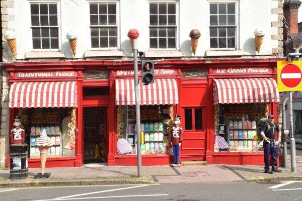
The sweetshop at Welshpool – after 134.5 miles, you’ve earned it!
Food and drink Grab what you can, when you can – and never pass up on the opportunity to eat and drink. You never know when you’ll get another chance…
Shops, banks and ATMs Outside of the four towns (Knighton, Llanidloes, Machynlleth and Welshpool) there is nothing except the occasional general store, which often doubles as a cafe (and occasionally triples as a petrol station too). In the towns you can expect a bit more, as well as cash machines.
Trekking companies and baggage carriers Many companies offer a luggage-carrying service and the whole self-guided tour package.
Dangers and annoyances
The weather, the livestock, the terrain, the sun, – there are plenty of things that could hurt you on the Glyndŵr’s Way. But perhaps what makes the Glyndwr’s Way slightly more dangerous than other routes is the fact that it’s so quiet. Which means, of course, that if you do get into trouble, help will probably not be near at hand.
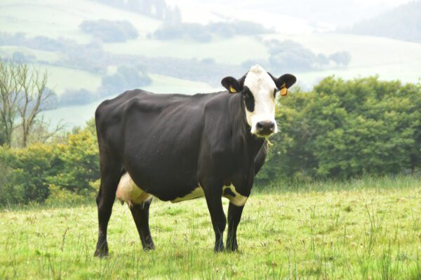
A typically wild and savage resident of central Wales
The Alien movies were fond of telling us, in space no-one can hear you scream; and the same applies to Powys.
So what can you do to ameliorate this? Well, before you even set off, persuading a friend or family member to join you is a good idea – it’s always safer on the trail if there are two of you. But if you are unable or unwilling to do this, then taking a mobile phone is, of course, pretty much essential – as is a battery pack (and the cable!) so you can charge it en route if necessary. But also tell someone of the itinerary you propose to follow; that way, if you vanish, they’ll have a better idea of where to look for you. Telling your B&B or campsite when you expect to arrive is also a good idea, for the same reason.
Finally, carrying a spare set of warm clothes and a very basic medical kit – antiseptic, plasters, the odd bandage or two – is also a very sensible idea; after all, help, should you need it, may take some time to arrive.
Tips and hints
1) Bring gaiters and trekking poles. These are two things that I have never used on a long-distance walk in Britain before. But gaiters could prove vital when you’re walking through one of the many bogs en route and your foot sinks lower than you were expecting. Similarly, a pair of trekking poles can help you find out which bit of boggy ground is safe to tread on – and which bit isn’t.
2) Double check everything. Chris Scott’s book on the Glyndŵr’s Way for Trailblazer is, like every other book he’s written, brilliantly researched and absolutely vital for anyone looking to tackle the trail. But things do change so always check opening times etc haven’t changed by directly calling the establishment concerned; and in the book Chris helpfully provides the phone numbers to help you do this.
3) Carry emergency supplies. When you leave any town or village, try to make sure you’re water bottles are full and you’ve got some emergency rations (trekking bars etc) with you – because you may not be able to replenish either on that day’s walk.
4) Read the advice on what to do when crossing cow and sheep fields before you set foot on the trail. You’ll be doing it plenty of times on this trip!
Further info
The Guide!
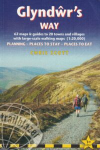
Practical, walking guide to Glyndŵr’s Way National Trail that runs for 134.5 miles (216.5 kms) from Knighton to Welshpool.

This Glyndŵr’s Way guide includes:
* 62 large-scale walking maps – the largest scale maps available – At just under 1:20,000 (8c or 3 1/8th inches to 1 mile) these are bigger than even the most details walking maps currently available in the shops.
* Unique mapping features – walking times, directions, tricky junctions, places to stay and eat, points of interest. These are not general-purpose maps but fully edited maps drawn by walkers for walkers.
* Practical informati0n for all budgets – What to see; where to eat (cafés, pubs and restaurants); where to stay (B&Bs, hotels, pubs, bunkhouses, camping)
* Itineraries for all walkers – whether walking the whole route or just the highlights on day walks and short breaks.
* Detailed public transport information – for all access points on the path.
* GPS/what3words waypoints – downloadable from the Trailblazer website.
Buy the book:
To buy the book from Amazon, please click the book below: