Do you need a map or guide book on your hike?
As someone who’s been writing guide books for the best part of three decades, it probably won’t be a great surprise to you when I tell you that I think a guide book is pretty much essential on any long-distance walk.
But even I will admit that there are times when a guide book seems a bit unnecessary.
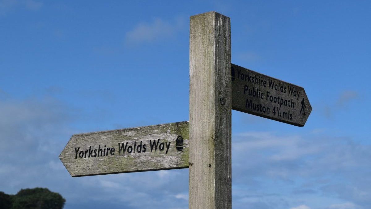
In particular, the National Trails of England and Wales seem to be so very well way marked these days, with signposts galore all along the path, that one of the main roles of a guide – that of helping you to navigate your way along the route without getting lost – seems, well, unnecessary.
Those who’ve used a Trailblazer book before will be aware of the idiosyncratic maps that illustrate the trail. Drawn by Nick Hill, I think they are far more useful than your standard Ordnance Survey map, as they are drawn to a larger scale, have more detail on them, and are filled with useful instructions on how to keep to the correct path.
But with each of the fifteen National Trails of England and Wales now receiving a decent budget from the government, and with much of that budget seemingly going on signposts, it does make you wonder whether you really need a guide book, or indeed even a map, anymore?
So I thought I’d test this theory by doing just that. My plan was to attempt to walk a National Trail without using a map or guide book.
For this experiment, I decided to walk the Yorkshire Wolds Way. Why? Well, for several reasons:
- At around 78 miles, it’s the shortest National Trail – perfect for an experiment such as this.
- It’s one of the few National Trails Daisy and I had yet to attempt, so I had no prior knowledge of the correct path.
- I just happened to be up in Yorkshire and had to hang around for a few days for my lift home. So why not walk a trail?
The idea was to set off from the starting point on the cliffs at Filey Brigg (the one part of the trail I was familiar with, as it also happens to be the end of the Cleveland Way), and attempt to walk the entire path, all the way to Hessle, on the outskirts of Hull, without using a book or map along the way.
That said, before I set off I did,download an app onto my phone. For this I used the Hiiker App. This, I promised myself, was only to be used in an emergency, to help me get back on the trail if I became hopelessly lost. The idea was that, while useful as a back-up, the App would remain unopened, and the route remain unseen, throughout my adventure.
That was the plan at least. Unfortunately, things didn’t get off to a great start. Setting off from Filey Brigg, the signposts correctly guided me for the first few hundred metres along the cliff tops to the seafront at Filey.
Where they then petered out. Leaving me to stroll, in complete ignorance, along the entire promenade at Filey, in blissful ignorance that I should have headed inland about 500m ago.
Which I only knew, because I had to look at the App to find out where the correct path was.
Score so far: App 1, signposts 0.
To be fair, after I left Filey the signposts did a good job of guiding me along the trail for the rest of the day, and indeed, for the rest of the entire three-and-a-half days I was on the trail. True, I think I did still look at the App several times each day. Mostly this was for reassurance, to make sure I hadn’t missed a turn-off and was still on the correct path.
But there were also occasions when the signposts were nowhere to be seen, particularly, as with Filey, when arriving and leaving a town or village. That would not have mattered if there were people around to ask for directions. But because the weather was so awful throughout the walk, that was rarely anyone around. And even if there had been, would they have known where the National Trail enters their village, and leaves it? I imagine that, dog-walkers apart, many locals won’t.
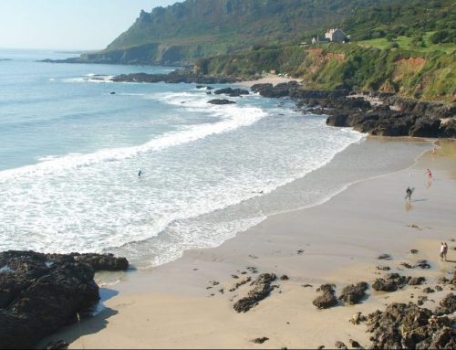
Eventually, three and a half days after setting off from Filey Brigg, I reached the Humber River and limped for the last few miles along its shore towards the Humber Bridge and the end of the walk. As if to mock me, the sun decided to break through the clouds for virtually the first time since I set off, and there was even a porpoise frolicking in the water alongside me as I approached the monument that signalled the end of my adventure.
To be fair, the signposts installed by those lovely National Trail people had done their job. In fact, I can’t think of a place where I went wrong when travelling between the towns and villages along the entire length of the Yorkshire Wolds Way. The only problem I found was that once you had reached the next village or settlement en route, there was a shortage of signs showing you where to leave it again. Thankfully, where the signposts did let me down, the App was usually there to make sure I kept to the correct path.
Which begs the question, of course: do you need to use the signposts, when the App was able to keep me on the trail all by itself?In other words, is it possible to follow the trail just using the App, with the signposts along the way just confirming that you are on the right trail?
To which I would reply that, yes, you can use an App to keep you on the trail. For the App did, sort of, guide me along the entire length of the Yorkshire Wolds Way. Which leads to a secondary question: is the App a replacement for a guide book?
I have to say that, in all honesty, no. Or at least, not at the moment. Of course, you would expect me, as a guide book writer, to say that.
But while I may have been writing guides for longer than I care to admit, I consider myself a walker first. I was hiking before I got into writing guides, and I’ll probably be hiking long after I’ve stopped writing guides too. And as someone who loves hiking, and carries his own stuff, I would love to see the day when I didn’t have to carry around a guide book, and could download all the information on my phone instead. After all, my phone has already taken the place of my torch, my laptop, my GPS and my camera, so to be able to get rid of my guide book too would be a great blessing.
I would love to see an App that can mimic a guide book – and it should be easily possible. But at the moment, the Apps that are available, and certainly the one I used, just didn’t measure up.
For one thing, the route that the App provided did not exactly follow the National Trail. To be fair, it usually did.
But there was one memorable occasion when the App took me to the village of Huggate, when the correct path should have turned off before it. It was at that precise momenty that I realised that what I was actually following was not the correct trail, but somebody’s own version of it. Somebody who had previously walked the Wolds, had marked their route along it, and presumably had then sent it to Hiiker.
The problem is, of course, that few people stick to the path religiously. So if this person who compiled the route for Hiiker had decided to turn off the trail to go and scoff a cheese scone at Rachel’s Walnut Cottage Tea Room in Huggate, then the App compelled me to go that way as well.
To some people this may not seem like a big deal. And for all I know, the cheese scones at Rachel’s Walnut Cottage Tea Room might be fabulous. But I wanted to have my own experience on the Yorkshire Wolds Way, and instead the App was making me live someone else’s adventure. And rightly or wrongly, that really annoyed me. Because I like to follow the official trail as closely as possible. In fact, if I do divert from the trail at any point, I like to then return to the trail at exactly that point, so I don’t actually miss any of the trail. So when an App takes me away from the trail in such a casual fashion, without any explanation or apology, well it really irks me.
Of course, this problem could well have just been a problem with the Hiiker App, and other Apps may be better at following the official route. But Hiiker did seem to be the most popular App that offered a map on the Yorkshire Wolds Way – so I assumed it was the best.
There were other problems with the Hiiker App. I found the information on the App it gave me to be just unreliable. A campsite, for example, turned out to be a B&B. A couple of eating places were missed, while others that were marked on the map had closed. Presumably, these mistakes are easy to rectify, and other Apps may be better at keeping their information up to date. But Hiiker wasn’t brilliant in this regard. It’s almost better to give the walker no information than wrong information; at least that will encourage walkers to do their own research. Otherwise, people will come to over-rely on the information on the App, and think it’s both reliable and comprehensive – at least, until experience tells them otherwise.
There is another shortfall with the Hiiker App that all Apps seem to have in common, and that is that no Apps currently offer any insight into what you actually see on the way. The Wolds Way is a wonderful walk with views aplenty; you are, after all, walking along the tops of hills for most of the time. But the App gives you no information on what it is you’re looking at – something that any half-decent guide book would do.
Speaking of half-decent guide books, they are also more likely to point out certain sights and attractions that my App distinctly failed to do. The Madhyamaka Kadampa Meditation Centre is housed in Grade II* listed Kilnwick Percy Hall. Set in 42 acres of landscaped grounds, the centre is not only a fascinating place in its own right but is also said to have a great cafe attracting people for miles around.
It is also not mentioned on the App. Which is really disappointing, not least because I was really hungry when I walked right past the path that leads to the centre. I don’t think it’s too much of a boast to say that any good guide would not only point out the centre, but would describe how to get to it too.
It could be argued, of course, that I just got the wrong App, and in a future post I’ll look at the various Apps available and try to decide which one’s best. But, of course, there is one criticism that can be levelled at all Apps: that they are only any good if your phone is both working, and if it has an internet connection. So if your phone runs out of juice, you’ll have to rely on the signposts, to keep you on the trail.
Conclusion
So, can you walk an entire National Trail using just the signposts along the way? In my experience, no. The National Trail people have done a great job making sure each trail is well signposted. But for whatever reason, the signposts tend to run out whenever you reach a town or village. And unfortunately, the bigger the town, the more you need a signpost to help you escape from it.
Can you walk along the trail using just an App on your phone? Yes, as long as you don’t mind following someone else’s walk rather than the official trail.
Is there an App that can replicate what a guide book can do, and thus make the guide book redundant? Alas, no – at least not yet, as far as I can tell. An App is, at best a decent substitute for a map; but whereas a map may weigh more and be more bulky, it also won’t run out of batteries.
And as I have pointed out elsewhere on this site, maps themselves are no substitute for a decent guide book.